I know I say I can’t wait to go back and visit every place again as soon as we leave, but in reality we do our best to visit as many new places as possible, so return visits aren’t really practical. Especially when those places are thousands of miles across the country. Our only exception…Page, Arizona.
We first visited Page back in 2018 on our first Arizona National Parks trip, the last time BU hockey played at ASU. And we fell in love! But we didn’t even get to scratch the surface of things to do in this area. When we started planning this trip as soon as we found out BU was going back to ASU, I knew I would do anything to make it so our path crossed through Page once again. And lo and behold, it did.
Page, Arizona is located at the convergence of at least four major geological areas: Grand Staircase-Escalante, Paria Canyon-Vermillion Cliffs, Antelope Canyons, and the Glen Canyon National Recreation Area.
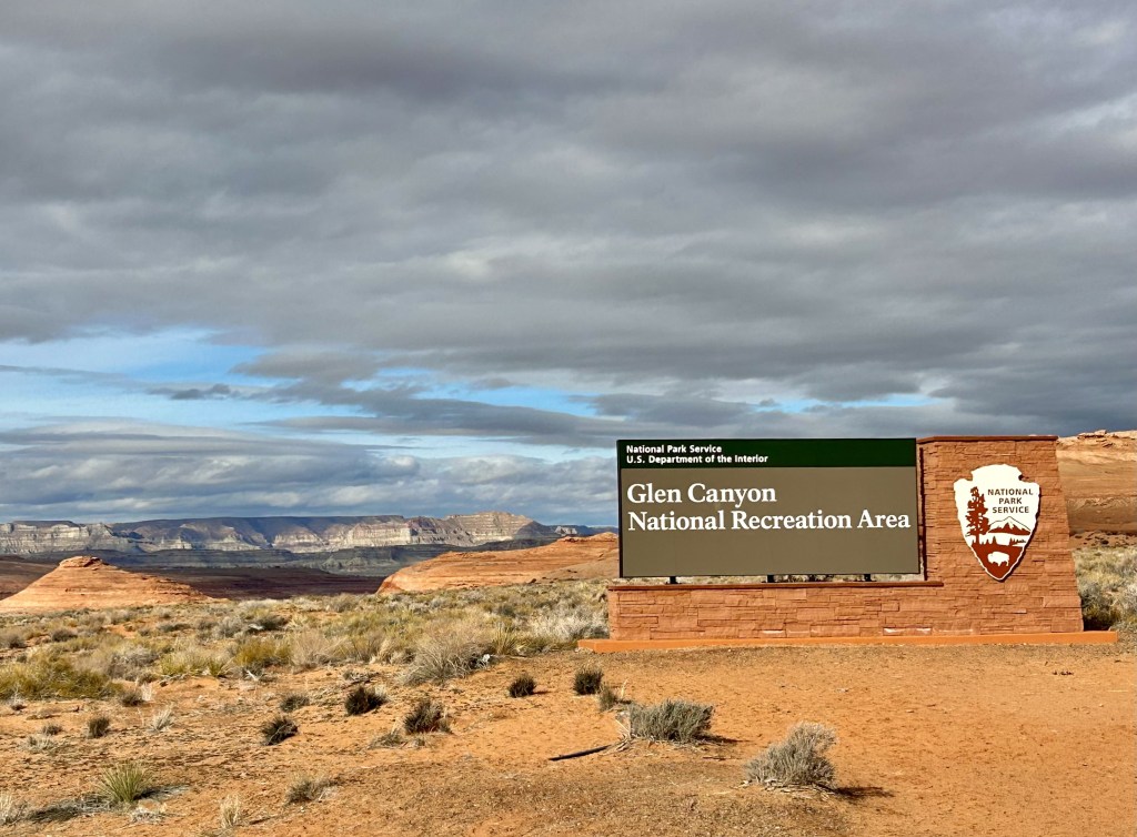
The entirety of Page, and Horseshoe Bend, lie within the Glen Canyon National Recreation Area, 1.25 million acres of land that surrounds the breathtaking Lake Powell. But I’m getting a little ahead of myself.
Probably the most sought-after activity in this area is hiking The Wave. A part of the Paria Canyon-Vermillion Cliffs Wilderness, the Wave is an Instagram famous hike through pink and golden grooved rocks. Getting a permit to hike The Wave is very difficult and requires entry in a daily lottery system. And even once you get a permit, it requires a high clearance vehicle to even reach the trailhead. It’s a lot of work. And wasn’t really feasible for us, especially at the tail end of this six national park excursion we were on.
In doing some research, I stumbled across mentions of The New Wave. A hike just outside downtown Page with similar rock formations, no permit requirements, and no crowds! I figured it must pale in comparison to the pictures I’ve seen of the actual Wave, but we had to drive right by the trailhead to get into the city anyway, so I figured why not?
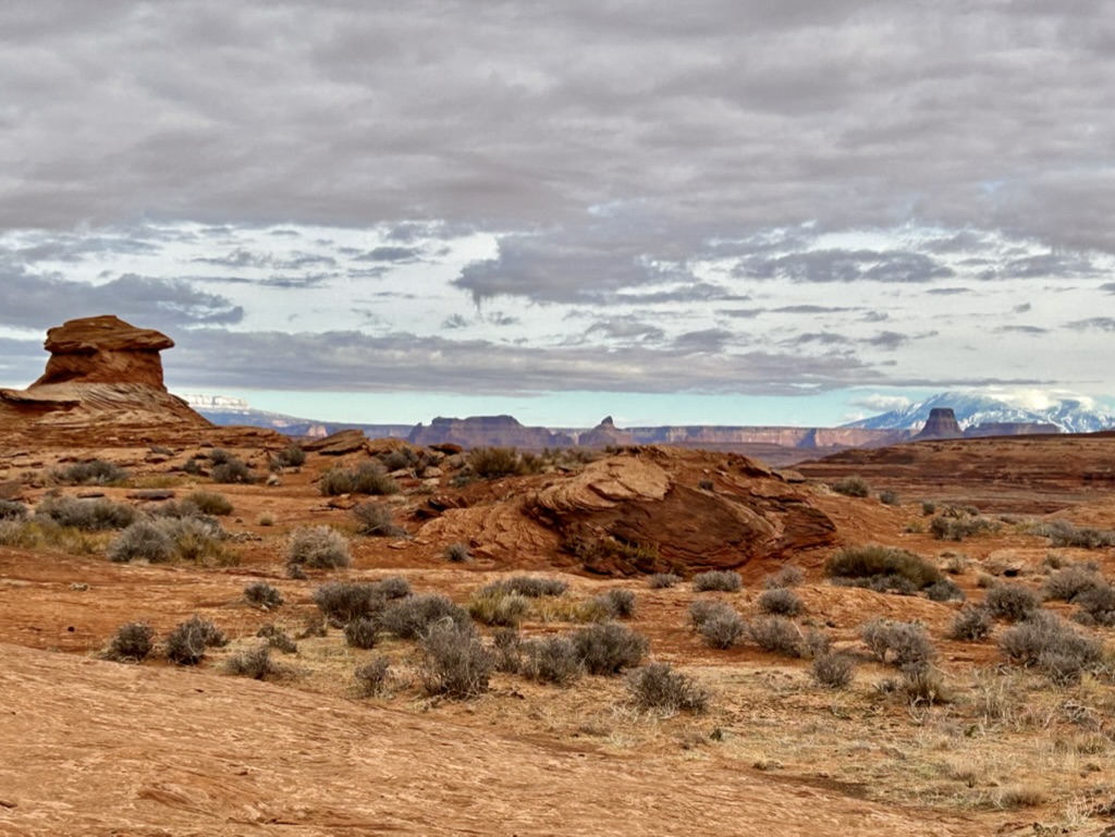
And we stumbled upon the best kept secret in Page.
It took a little bit of driving around the dirt roads surrounding this rock formation before realizing I could just park wherever. It just seemed odd because there literally was not a single other soul around.

From there, we just took off up the sides of the rocks and began exploring. Eventually we discovered there was an actual trail you could follow, marked by these little rocks in some parts. But mostly, you could just roam wherever.

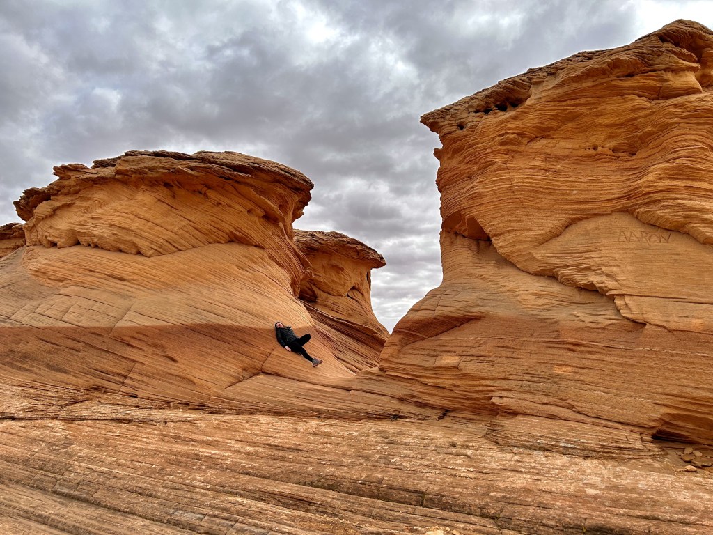
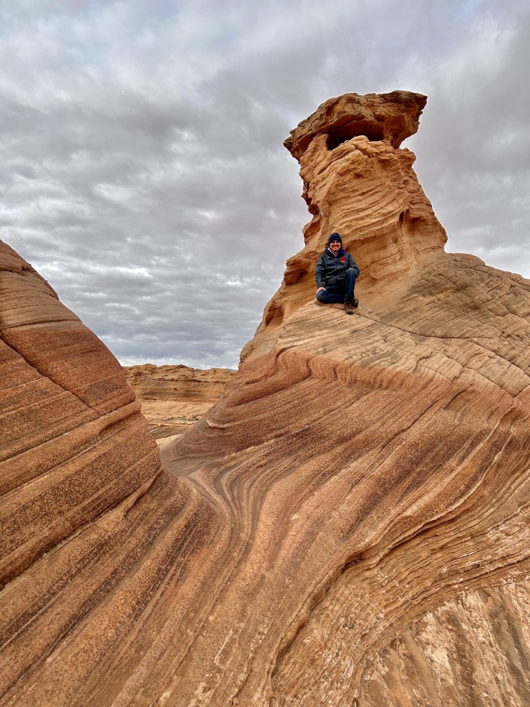
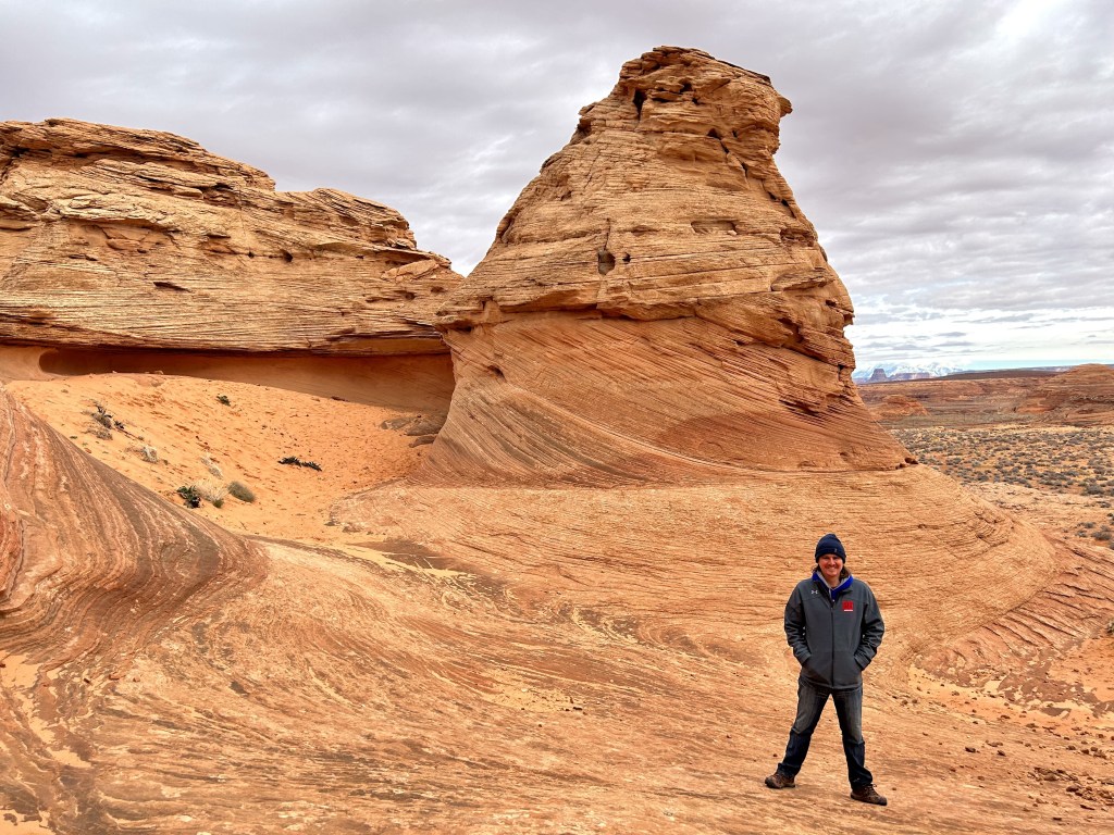
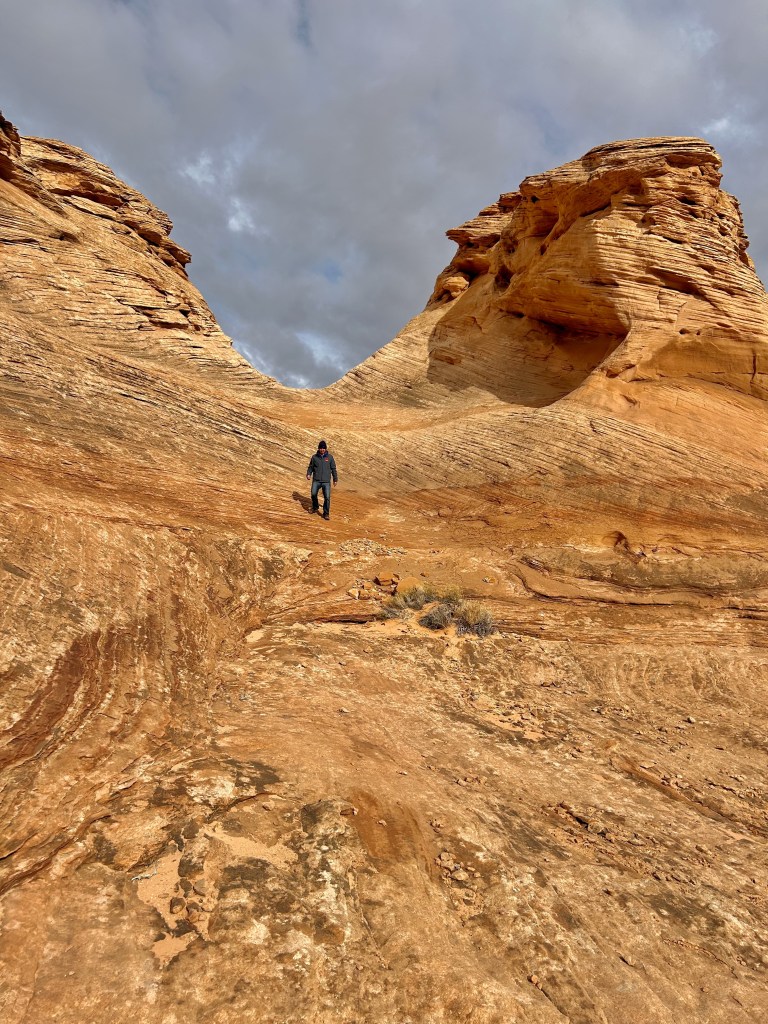
A giant field of the most interesting rocks I’ve ever seen to just climb and explore endlessly? I was a very happy camper.
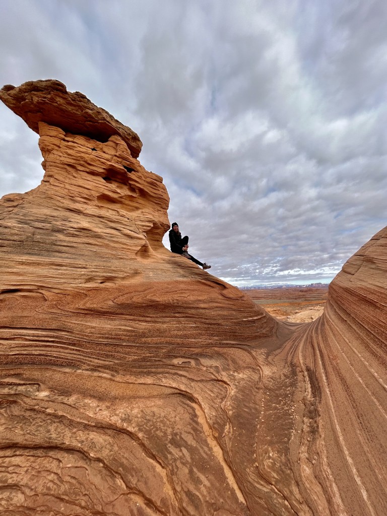
Pictures really don’t do it justice. Just the sheer size of these rock towers. And the thousands of layers of lines all compacted on to each other. It was breathtaking.
Here’s me for scale:
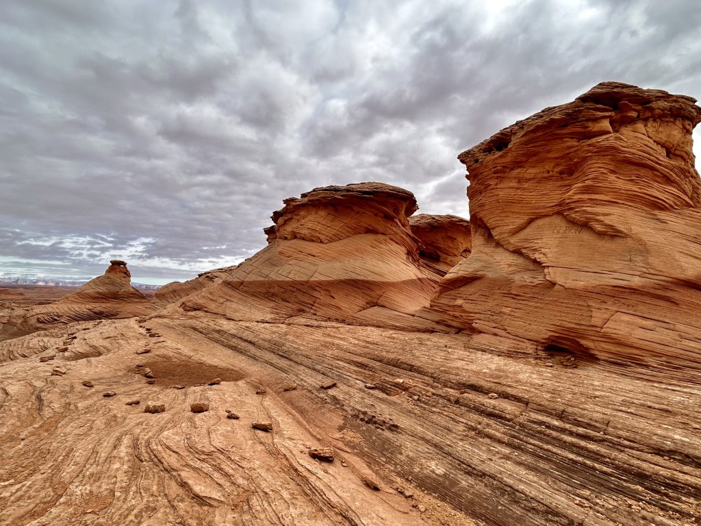
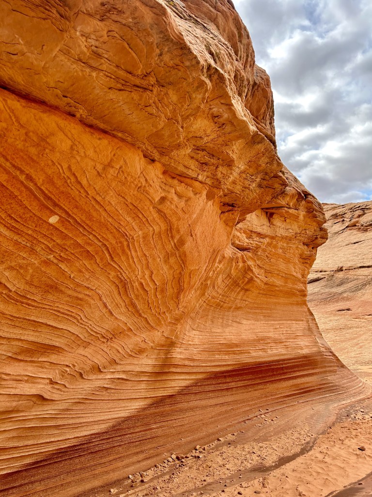
And a close-up of the rock walls:
It didn’t seem real.
It made me want to shoot a Star Wars movie. Or go rob a bank and bury my millions out here.
But my partner in crime and I kept the felonies to a minimum.
And instead spent what felt like hours climbing over these incredible formations.

By the time we were ready to leave, two more cars had shown up and I was so happy that other people were getting to experience this too. Look, I know how corny that sounds. But I was genuinely blown away by this place. And the day was only going to continue getting better.
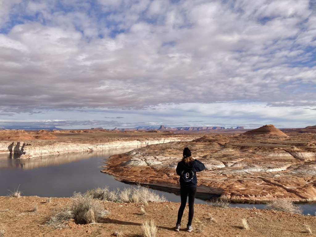
Less than a mile before we turned toward the New Wave Trailhead, I had seen a sign for a Lake Powell Viewpoint. So after bidding adieu to the rocks, we decided to backtrack a little and check it out.

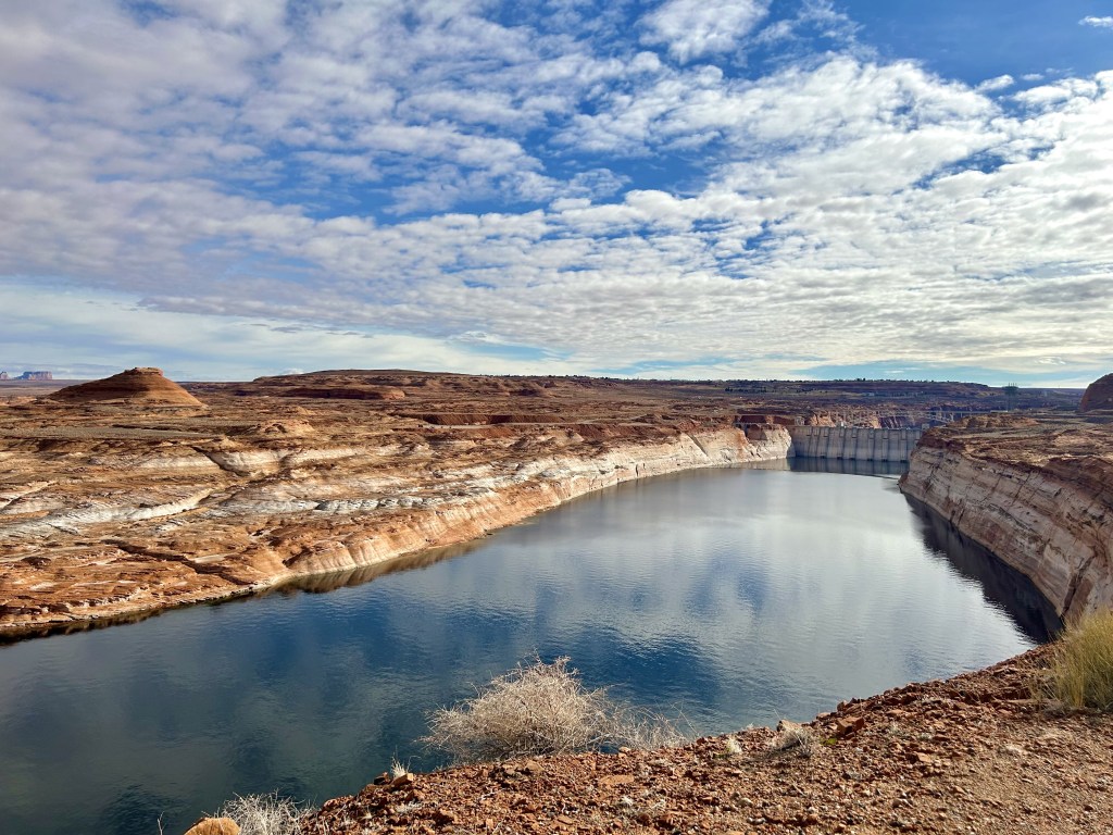
It did not disappoint. We obviously vaguely drove by Lake Powell on our first trip here in 2018, but we mostly went straight to the Antelope Canyons and Horseshoe Bend and really didn’t give it the attention it deserves.
We weren’t going to make that mistake twice.
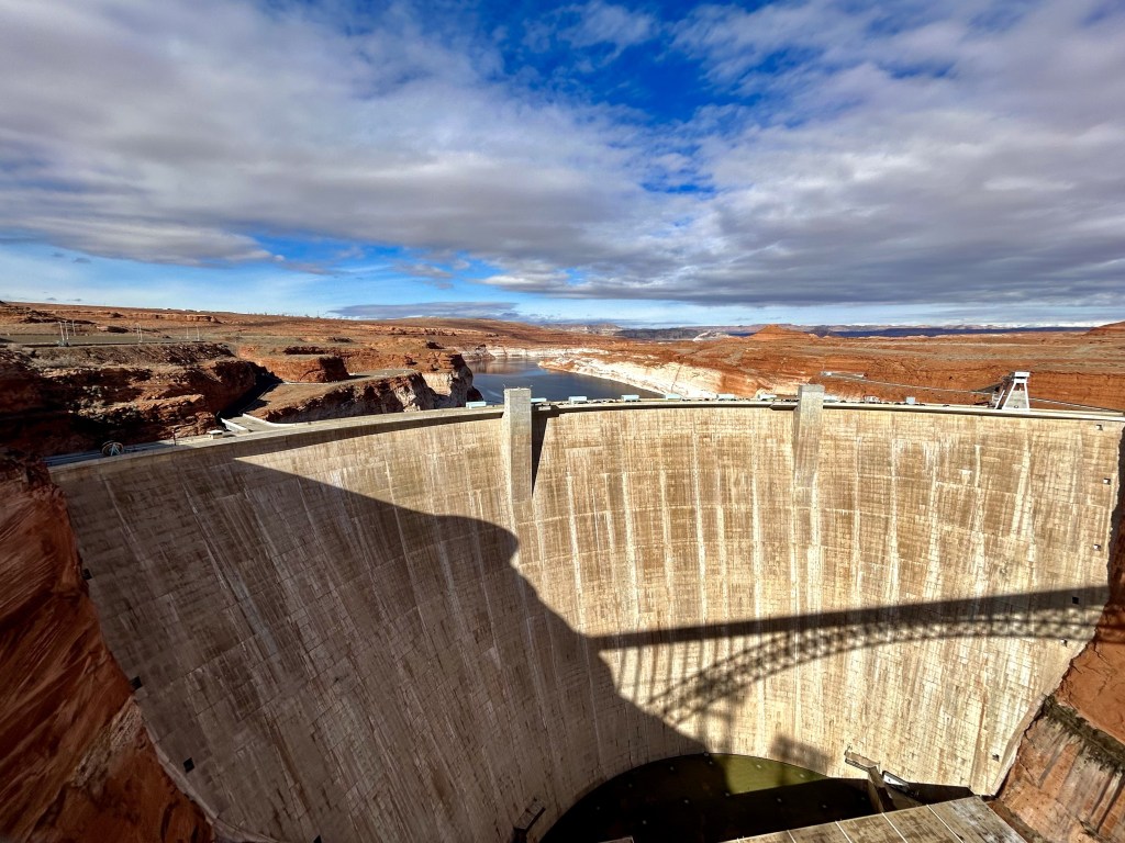
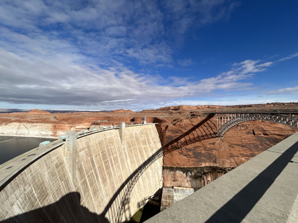
But first, we had to get a closer look at the Glen Canyon Dam.
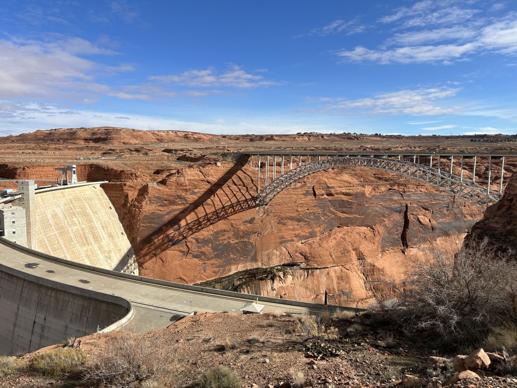
The Glen Canyon Dam is the fourth tallest dam in the United States and creates the second largest manmade lake, Lake Powell. The only larger manmade lake is Lake Mead created by the Hoover Dam, although Lake Powell has gotten bigger in years past depending on droughts.
The dam was built to ensure proper water distribution between the Upper Colorado River Basin (Colorado, Wyoming, New Mexico and Utah) and Lower Basin states (California, Nevada and Arizona). The Colorado River had to be diverted around the area through tunnels during construction of the dam which, honestly, I’ve tried reading a lot about and I still have absolutely no idea how that happens. The dam was completed in September of 1963 and it took 16 years to flood Lake Powell to its proper depth, though it fluctuates greatly depending on snow runoff from the Rocky Mountains on any given year.
The dam does not come without its rightful criticism. The Colorado River experiences a 6% evaporation loss every year because the dam slows the flow of water. It’s such a sediment rich river, but sediment cannot pass through the dam and gets caught on the Lake Powell side and is slowly building up, changing the makeup of the Colorado on the other side. This is why the water at Horseshoe Bend is that beautiful blue-green color, the sediment has mostly been “filtered” out of the water.
Within the next 300 years, the dam will be completely unusable if nothing is done because sediment will be blocking the ducts. Nearly 30,000 dump truck loads of sediment per day are building up in Lake Powell. The Colorado River can no longer build natural sandbars and islands in the Grand Canyon because of this lack of sediment. It also can’t flood in the canyon which has lead to changes in vegetation and overgrowth. It’s also led to much cooler water temperatures which has caused more drowning deaths and hypothermia in the Grand Canyon, as well as impacting the fish population. It’s kind of crazy to think about the ripple effects this single dam has had over several states and ecosystems, even drying up some deltas all the way down in Mexico.
And that has been your history lesson for the day!
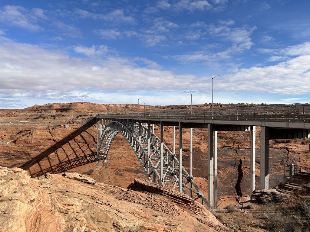
Unfortunately, the visitor center was closed because of the holiday, but we were still able to walk around the area and walk across the bridge. Which was really freaky. Standing in the middle of the bridge when a giant tractor trailer zoomed by behind me was very uncomfy.
From there, we went over to get a closer look at Lake Powell itself. Now, Lake Powell is almost 200 miles long and the surface takes up some 160,000 acres so we quite literally didn’t even scratch the surface of this lake. Literally. I would love to go boating and swimming someday. But that’s not to say that we didn’t get our money and time’s worth.
The below picture is probably my favorite picture I took of this entire trip. I know there are more iconic shots of Lake Powell, there’s that one Instagram hike that I will obviously be doing someday, but this to me was perfect. The clouds. The color of the water. The dam and bridge in the background. The two boats heading for each other. It was like a dream.
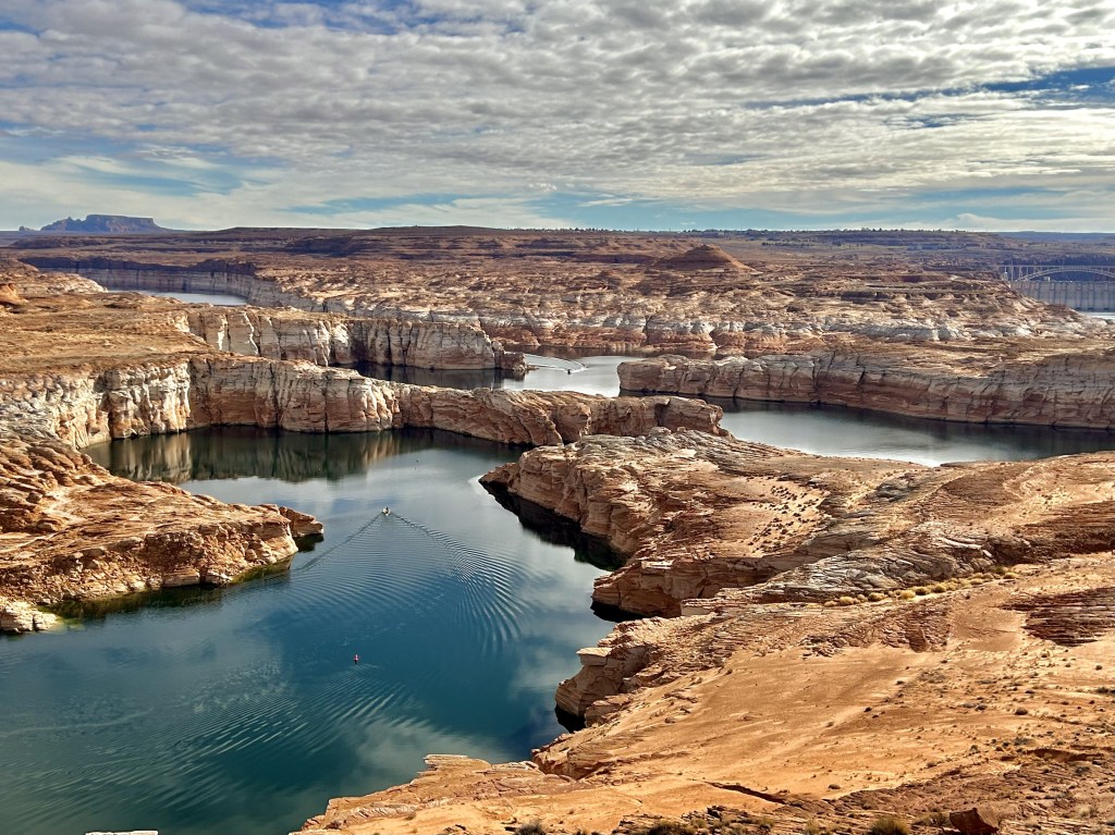
Next time we’re in Page (and there will obviously be a next time), we’re definitely going to rent a boat and see it from the water because I can’t imagine what those rock layers look like from below. It must be so magical.
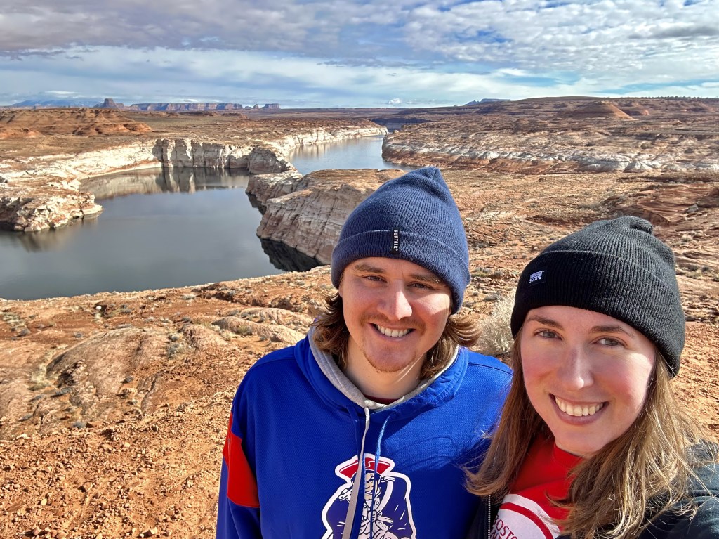
We reluctantly said goodbye to the lake in search of some food so that we’d have plenty of time to enjoy one of our favorite places in the world before sunset: Horseshoe Bend!
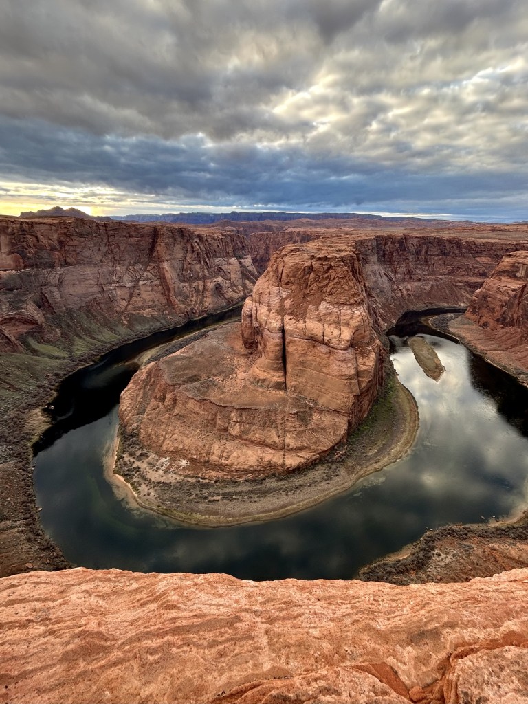
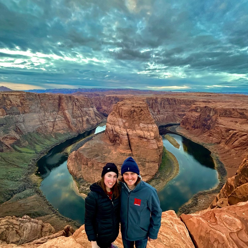
Oh boy oh boy, can things change a lot in five years? When we came in 2018, Horseshoe Bend was accessed by a tiny little dirt parking area and a quick scramble down some rocks to the cliffs edge. That is very much not the case anymore.
Thanks to its growing popularity on social media, this area is now completely run by the Parks Service and the City of Page. They paved a .75 mile path down to the lookout, put up safety fences and viewing areas, and built a giant parking lot at the top. And I couldn’t believe how crowded it was on a random Wednesday in early January! Parking is only $10 per car so no worries there and I liked the new paved trail. It makes it accessible to everyone and there are plenty of shady benches along the way to rest if you go in the dead of summer. I was very impressed and pleased with all the improvements, but it was very disorienting.
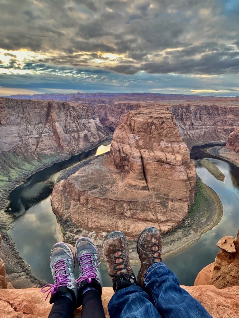
For example, James really wanted to recreate the above picture that he took in 2018 and we could just not figure out where we had taken it. The entire area looks so different and we couldn’t gauge how far away we had wandered or where the old trail had even let us out. So we settled on this:
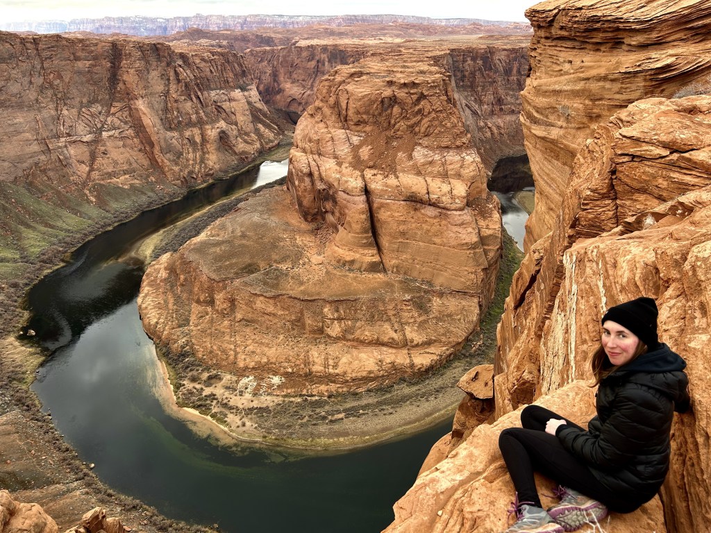
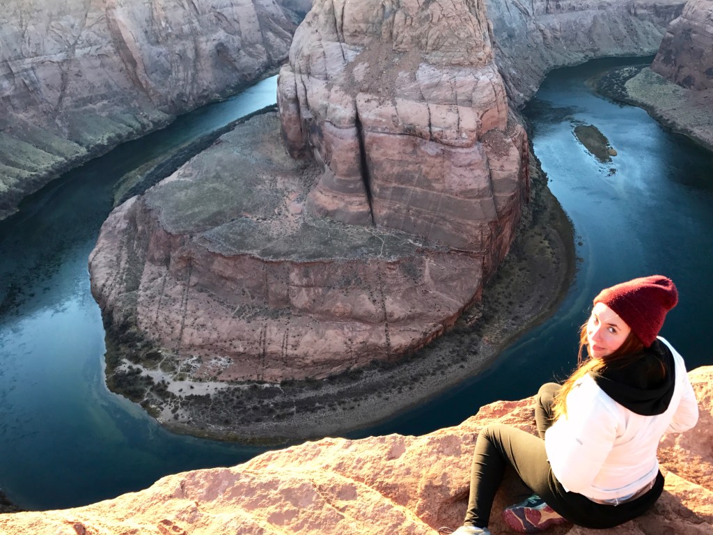
But it definitely wasn’t the same. Even with the increase in people, if you’re willing to wander and climb around, you can still definitely find places to yourself. I obviously spent over an hour climbing on different rocks, but then we were pretty content to just sit on the edge and watch the colors of the surrounding rocks change and evolve as the sun went down on our last day out in the wilderness.
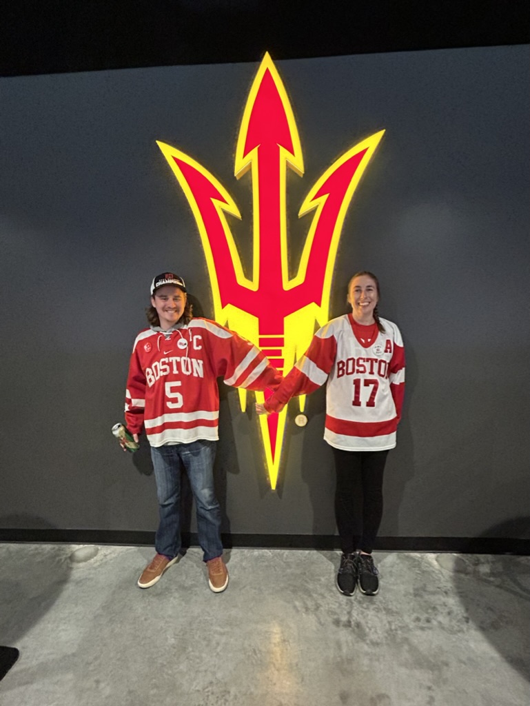
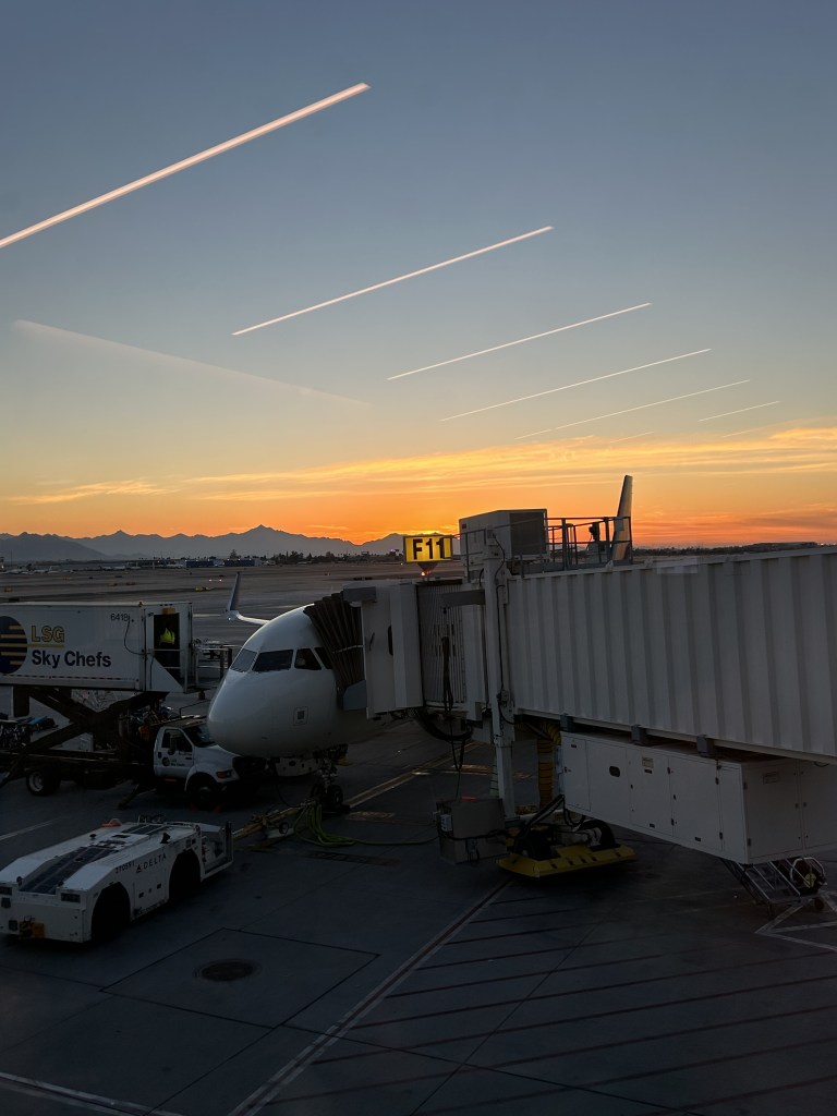
Because the next morning it was time to drive back to Phoenix for the “real reason” we were there. To watch some BU hockey games in the desert.
And to, I don’t know, actually relax on this vacation.
And to have beer and coffee for breakfast by the pool of our AirBNB.
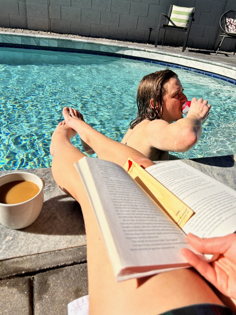
That’s the life.
Well, it only took me 8 months to post everything we did on this whirlwind of a trip, which mostly just speaks to how much of a procrastinator I am, but also how much we really jammed in. And I’m glad we ended the adventure part of our trip, in one of our favorite cities in the country. Page will always have a special place in my heart. And the truth is we still haven’t even begun to see and do all there is to see and do. There are more slot canyons that need to be climbed through, more corners of the Vermillion Cliffs that need exploring , and several hundred miles of Lake Powell to hike around and paddle on.
So you know what I’m gonna say next, right?
We’ll be back. Just as soon as we can.
