It was just a 35 minute drive up the road from Arches National Park to Canyonlands, our second stop in the Utah Mighty Five!
Several people recommended a stop in Dead Horse State Park on the way. It’s only a few miles off the main road between the two parks and offers spectacular views of the canyon and the Colorado River. But it’s $20 to enter the park and the National Park Annual Pass doesn’t count, so we decided against it, assuming we would get plenty of great views at Canyonlands.
I forgot to mention in my last post that the altitude sickness was finally gone! These parks were all well over a mile in elevation and I was feeling great. Hiking, sleeping, existing…all of it was so much easier now! Acclimating in Albuquerque for several days really paid off.
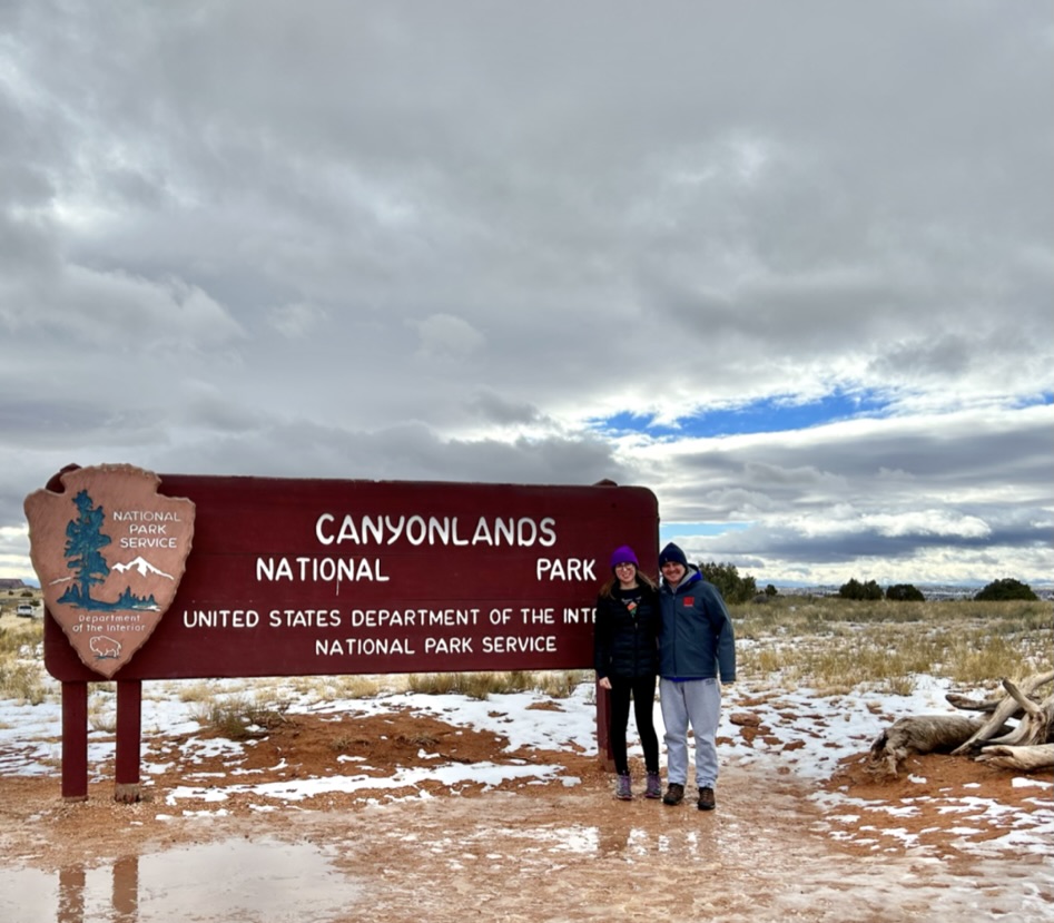
So on to Canyonlands! Canyonlands is divided into three districts, all separated by the rivers (which can also count as its fourth district): Island in the Sky, the Needles, and the Maze. You can’t get to all three from inside the park because of the rivers, so we stuck to Island in the Sky, the most popular of the three.
I can’t really explain it, but it very much felt like they just didn’t want you to be in Canyonlands, especially in the winter. You can only get water inside the visitor center (which closes at 4pm). There are no flush toilets or sinks anywhere in the park. They don’t plow the main road through the park. And there’s only one tiny campground with very few available sites. It really felt like we weren’t meant to be there. But challenge accepted!
Yet again, we decided to press our luck and try to get one of the few first-come first-served campsites in the park. We arrived pretty close to sunset, so we just got a couple of the main viewpoints out of the way before heading to the campground.

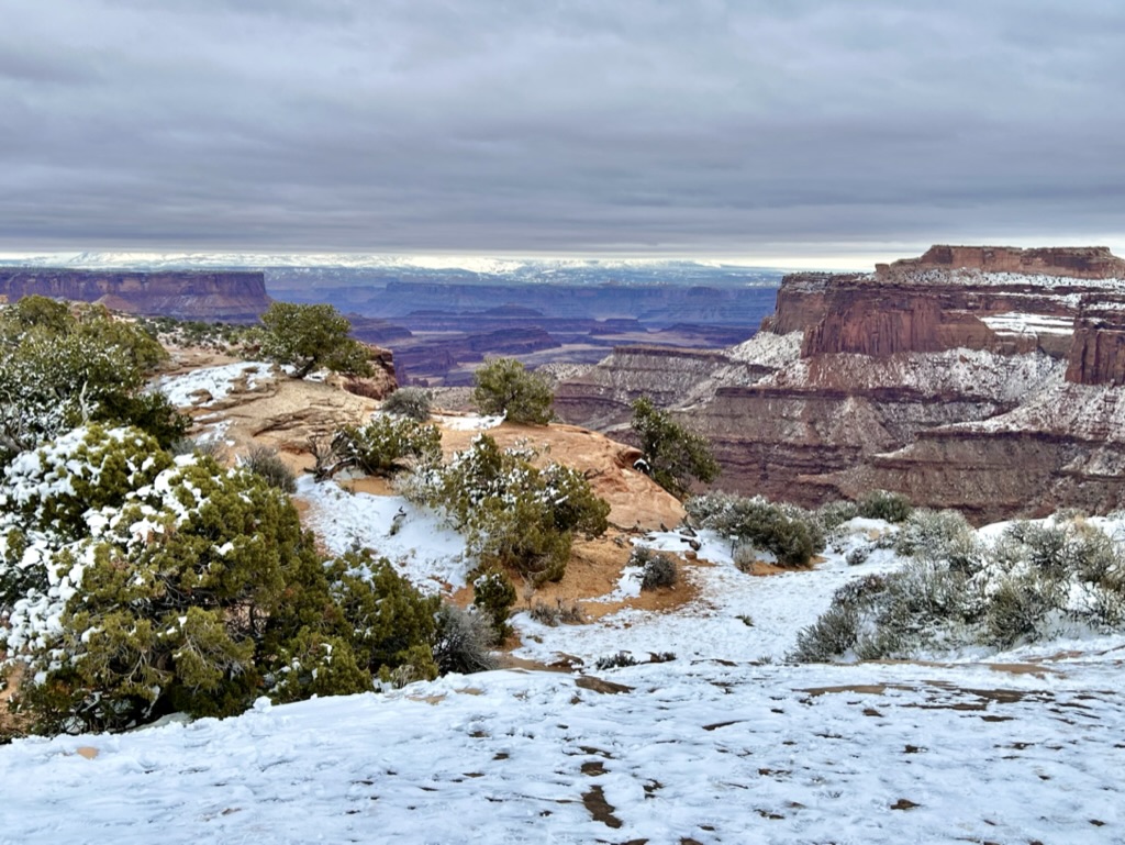
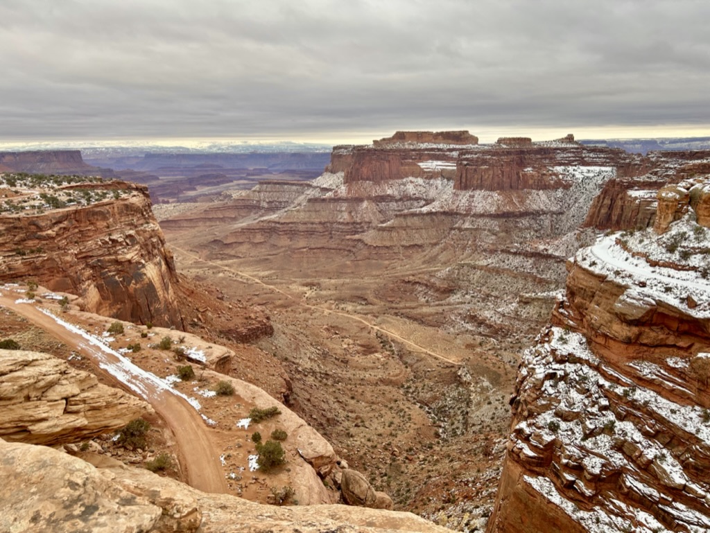
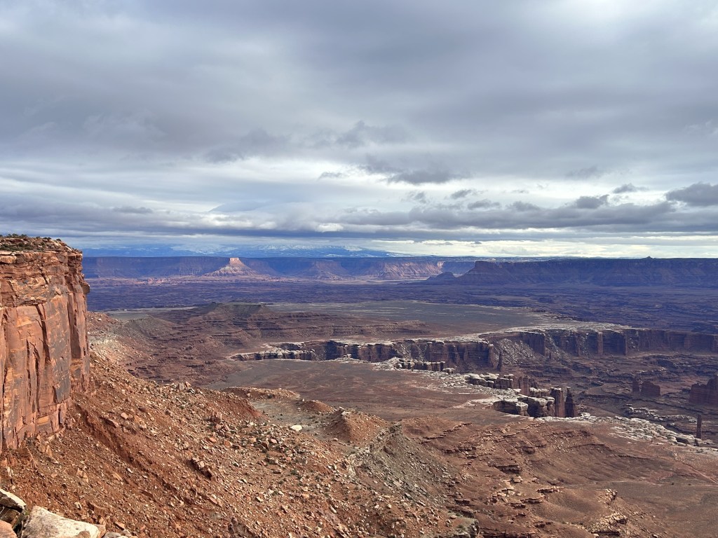
First up was this awesome Shafer Trail Overlook! That isn’t a hiking trail, it’s a road. Absolutely insane. Obviously you’re not supposed to go on it in winter and, even in the best conditions, you NEED a 4-wheel drive high clearance vehicle to drive on it. This Shafer Canyon Road brings you down to the White Rim floor, 1,200 feet down. (For context, that’s how far we hiked down into the Grand Canyon when we were there, only 20% of the way down.)
Once you’re on the White Rim (which is still another 1,000 feet above the rivers), you can drive the White Rim Road around the entire rim floor, driving just inside the rivers that encase the Island in the Sky District. It’s a 100 mile road that takes 2-3 days to complete, with several campgrounds (with toilets!) to stop at along the way. You can also bike it, but you need to have a trail vehicle to help carry enough water for you. I would love to rent a vehicle and do this drive someday. The isolation alone seems incredible. Everyone is 1,200 feet above you, the rivers are 1,000 feet below you. It’s just you, the wildlife, ancient hieroglyphs and abodes, and a few other travelers just as crazy as you are.
We hung out for awhile at the Shafer Canyon Overlook and climbed on some rocks, watching the rim road disappear into the distance.
But finally, we headed for our last stop of the evening before the campground: Green River Overlook.
This district of the park is enclosed by the two rivers, the Colorado and the Green River, which form a V around this section. Our campsite was on the western side, just minutes away from the Green River Overlook, which looked out at…you guessed it, the Green River. It felt like another planet.
The sun once again decided that it didn’t want to peek out for sunset, but it was still beautiful. And the campground was only a couple of minutes up the road so we were able to get there and get everything set up before it got dark. I was much less worried about actually finding a site in Canyonlands because I knew it was way less popular and we were there the day before New Year’s Eve. So needless to say, we had our pick of the lot. There were only a couple other campers there.
Now, prepare yourself for this park’s long-winded ridiculous anecdote. The story of the stupidest way anyone has ever gotten rained on while camping.
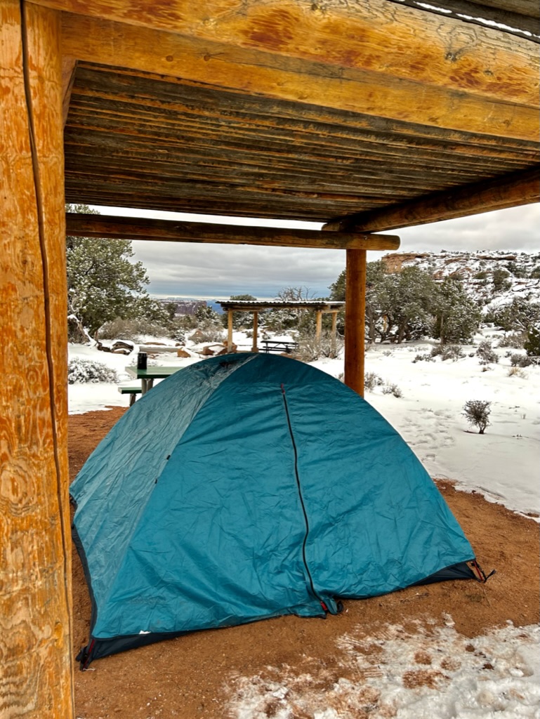
So, as you can see, these were really nice campsites. They even had these little shelters that are meant to protect you from the sun in the hot summer heat, but also worked wonders to protect the ground from the snow so we didn’t have to pitch our tent on top of several inches of snow. I was pretty pumped at this point. So remember when I said it snowed the night before at Arches and that would be relevant to a future story? Well congrats, this is that future story.
So after setting up our tent under this wonderful shelter, we accidentally put our rain fly on upside down. It was pretty wet on the inside because of the condensation from the snow we got the night before so we assumed that had been the outside. It wasn’t until everything was all clipped in and tied down that I realized what we’d done. And at this point I figured, what’s the worst that could happen? There was no rain in the forecast. The fly is still mostly waterproof inside out. And we were under this shelter. No problem! Right?
Well, I failed to factor in a couple of variables. One: while it wasn’t going to rain overnight, the temperature was going to increase by about 15 degrees in a matter of hours. And two: that wonderful shelter we pitched our tent underneath? It wasn’t waterproof. It wasn’t meant to be, it was only there to provide shade. The slats of wood had plenty of space between them for say….lots of melting snow to fall through. So, yeah. The temperature climbed, all the snow up on the “roof” started to melt, and it started to “rain” down on our tent underneath. Now usually this would be totally fine. This tent has been through MANY a rainstorm. But remember how we put the rain fly on inside out? Yeah, we’re complete morons. So all this melted snow began pouring onto our tent and sliding through vent in the rain fly (which wouldn’t happen if it was right side out) and dripping onto our sleeping bags.
I realized what was happening around midnight. James had long since fallen asleep and apparently didn’t notice that he was getting rained on. Though the morning light would reveal that it was mostly just falling on me. So I had two options here: get up in the cold, damp night to flip the rain fly over (the rain fly that was now soaking wet), completely exposing the tent to the “rain” in the process and probably getting everything immediately drenched. OR I could do nothing and let the rain slowly drip on us throughout the night and be mostly dry as long as it didn’t soak through my sleeping bag. I chose Option B.
Now on top of all of this, the drastic temperature change also made it SO WINDY! I have no idea how James was sleeping. I got legit afraid that our entire tent was going to rip out of the ground and fly away with us in it. This may have been another reason why I was not willing to get up. So some water was also getting in from the sides where the wind was violently ripping up the fly and exposing the mesh of the tent. Really fun times all around.
At some point, I did manage to fall asleep for a couple of hours. Somehow. And then as soon as I saw morning light, I immediately got up and started assessing the damage and carrying things to the car. It was worse than I feared. My backpack was SOAKED (luckily my laptop was okay). And there was a puddle the size of Lake Tahoe in the corner by James’ feet. I have no idea how he didn’t wake up. Luckily, the onslaught of melted snow rain had ceased at this point and I was able to take off the rain fly, shake it out, and shove it in the trunk to deal with later. Then I just had to wake James up and do our bests to avoid getting everything we owned even more wet. It was quite comical.
We folded up the tent and carried it to the car and I am honestly not exaggerating at all when I say there was at least 3 gallons of water in that sumbitch. It took a minute to find an opening to release the giant water bubble and it GUSHED out. Thankfully we had a hotel room for the next night, so we just shoved everything into the trunk knowing we could dry everything out there later. And we walked away with another valuable lesson learned: ALWAYS PUT YOUR RAIN FLY ON CORRECTLY. Even when it’s not going to rain. Even when you have a shelter overhead. We learned so much on this trip.
However, it was all worth it to camp in the actual park. Because then we got to roll out of our very wet bed, hop in the car, and drive a couple minutes up the road to an amazing sunrise hike!
We didn’t even change out of our pajamas. Though James did have to change out of his wet socks. (And we DID put on our spikes because the trail was super icy and we had already learned that particular lesson.)
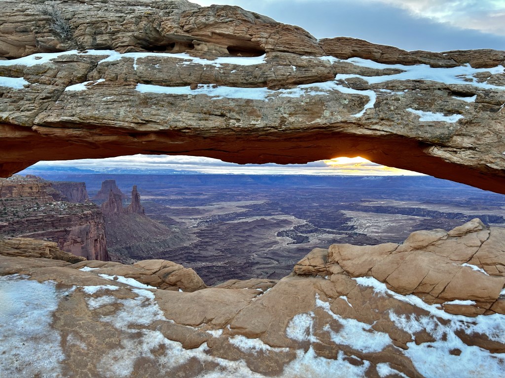
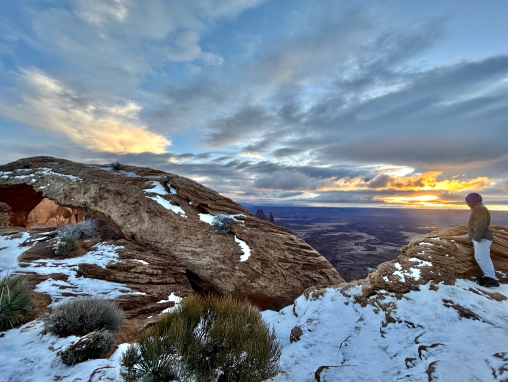
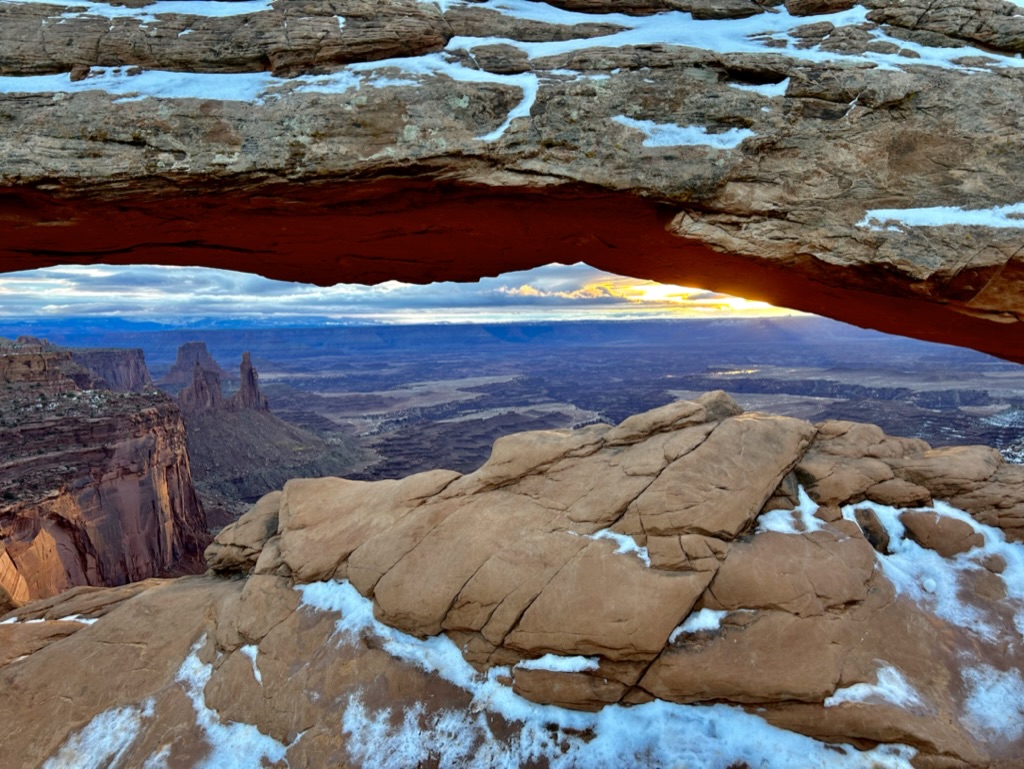
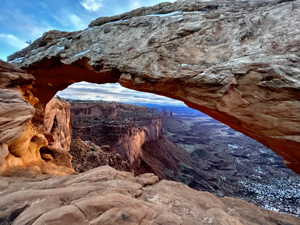
Mesa Arch is the most popular sunrise spot in the park and there were quite a few people there even before us. We were lucky that it had gotten so warm overnight because the parking lot was an ice trap when we drove by it the night before, but by the time we got there the next morning it had melted into a mostly manageable slush pile.
I was very bummed that you aren’t allowed to climb on top of the actual arch, but I know it’s for the best. Plus, it would just become another landmark where people wait in line to get *the* shot and ruin everyone else’s experience. It was so tempting though.
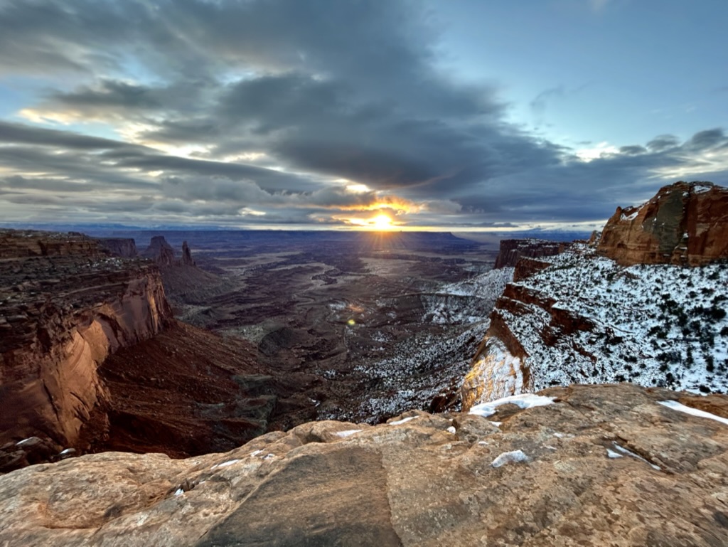
We stayed and watched the sunrise play out and dance in and out of the clouds for awhile, climbing on all the rocks to try to get the best views. The perfect start to any morning, in my opinion.
We also silently laughed at all the people who didn’t have spikes and were struggling to get around. Everyone has to learn this lesson sometime!
We could’ve stayed for hours, but we were on a semi-tight schedule. We needed to get to the Capitol Reef Visitor Center before 4 because it was New Year’s Eve and they were going to be closed the next day. And what’s even the point of going to a national park if you can’t get a sticker and a stamp in your passport? I’m kidding…kinda.
So we continued on our journey.
I didn’t make a ton of concrete plans in this park because the parts you can access in the winter with a little rear-wheel drive car are pretty limited. There was also a snowy and icy road conditions warning in the park and I wasn’t sure how much would be passable. There were some sketchy parts, but our little car made it work.
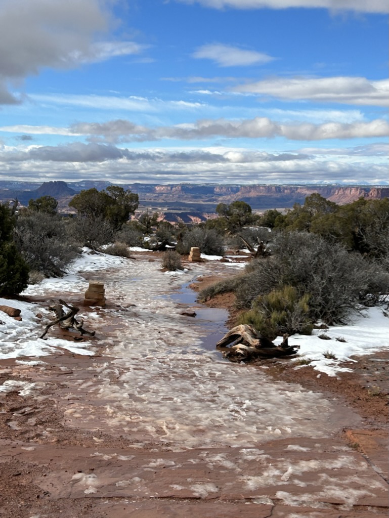
We ultimately decided to go to the Upheaval Dome trailhead so that we could check out all of the main roads. We were the only ones in the parking lot when we got there and we didn’t see a single other person the entire time we were there. We boiled some water at the picnic tables for some tea and oatmeal for breakfast, strapped on our SPIKES, and headed off on the trail.
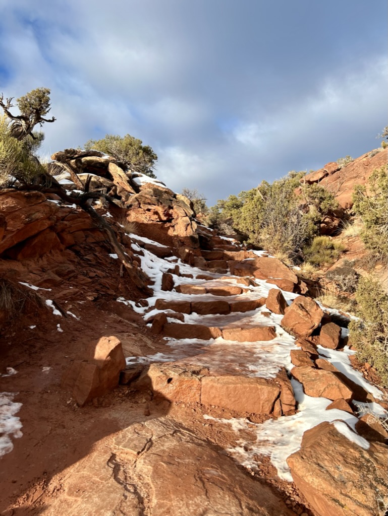
We ended up having to take our spikes on and off throughout the hike because it was really icy in the shade, but straight rock where the sun was hitting. But it was still definitely worth it to have them.
Upheaval Dome is a fascinating landmark. They literally don’t know how it got there. It could have been from a meteorite or it could have been just a naturally occuring salt dome. NASA scientists have studied it intensely and still can’t confirm for sure that it’s a meteor crater, though that is the most popular theory.
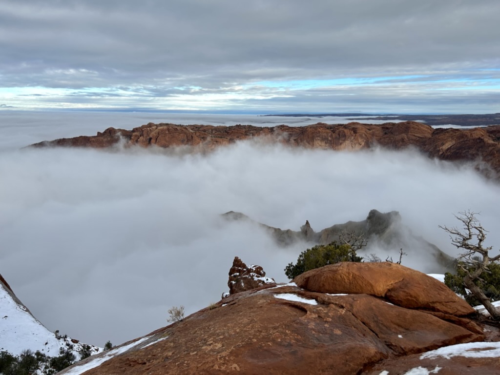
The crater is 6 miles wide and has that interesting formation popping up in the middle. And it looked WAY cooler with the fog. It hit us very quickly exactly why they call it the Island in the Sky (okay, James realized immediately why it was called Island in the Sky…it took me a minute). The low clouds were incredibly cool!
The way the clouds blew in the wind and rolled over the canyon walls behind us made it look like a giant waterfall. We could’ve hung out above the crater watching it all for hours if it wasn’t so darn windy.

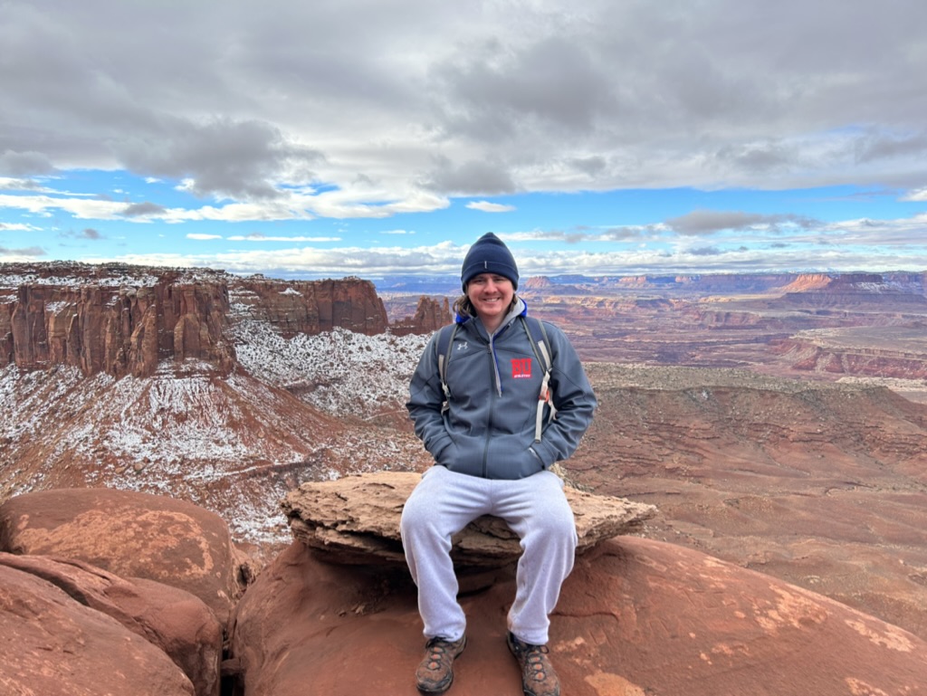
From the East side of the park near Shafer Trail you can see the La Sal Mountains (the same ones from Arches) in the distance. On this Western side of the park, you see the Abajo Mountains to the South. We were surrounded by beautiful snow-capped mountains in the distance, with dramatic canyons and cliffs in the foreground, and fog filling in all of the cracks in between. The layers of it all were truly mesmerizing.
There was another hike I wanted to do in this section of the park, to False Kiva, but the trail was permanently closed in 2018 due to vandalism. The trail went to a kiva, a partially underground spiritual chamber, that overlooked the beautiful red rocks. But people are absolute garbage and have carved graffiti into the rock, lit fires within the religious ring, and drew on the walls with ash. Disgusting. You can still technically hike out to it, but the park stopped advertising the trail and closed the parking at the trailhead. Plus, you aren’t allowed to actually climb down into the religious chamber anymore so it’s not really worth all the trouble. Which really sucks. They might consider reopening it someday if they can figure out a way to control all these factors, but it doesn’t seem too likely. People really truly suck.
So instead of getting to enjoy an amazing spiritual kiva, it was time to say goodbye to this section of the park and check out one last hike before heading on our way to Capitol Reef.
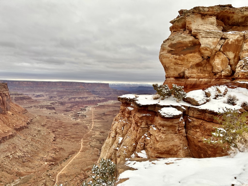
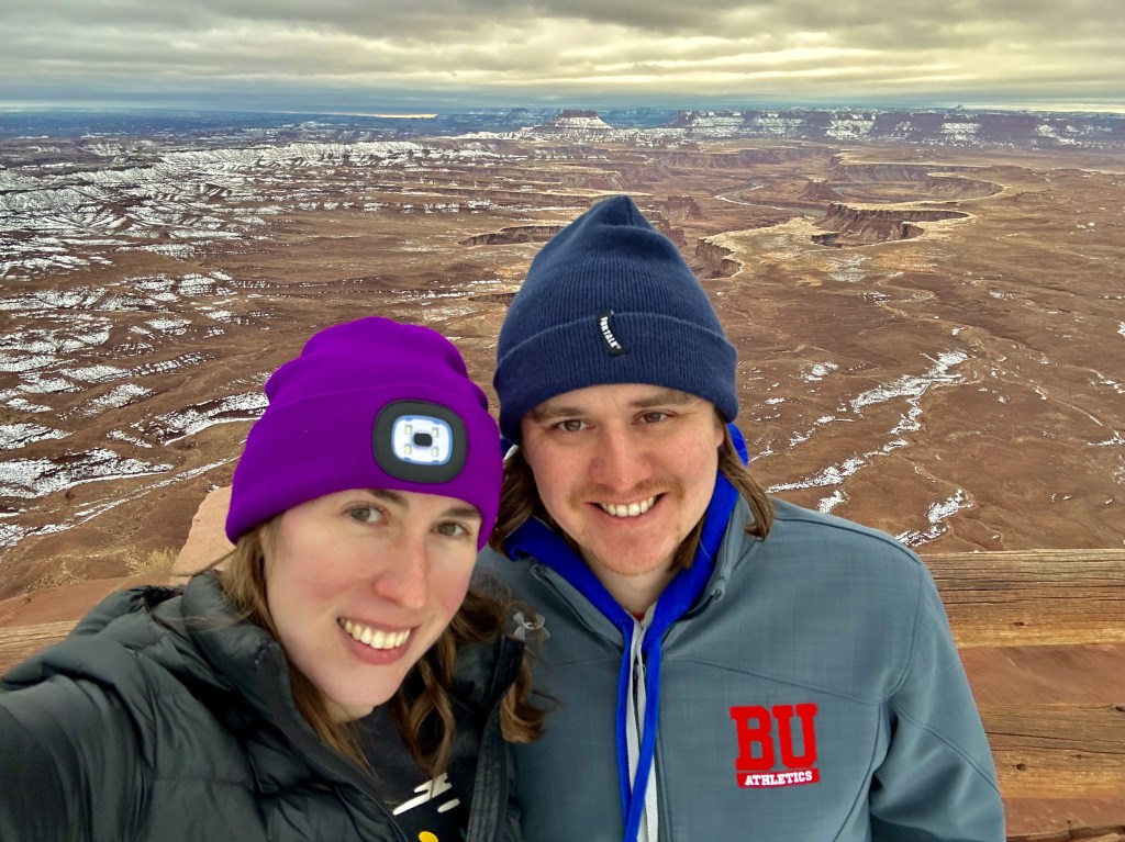
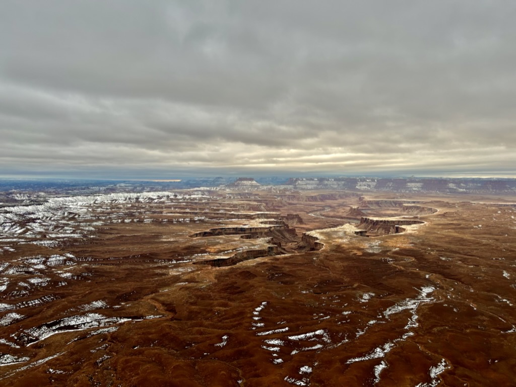
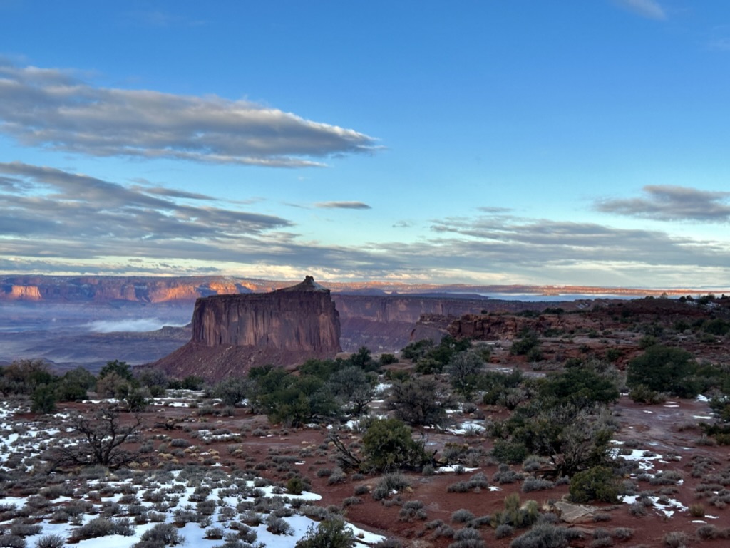
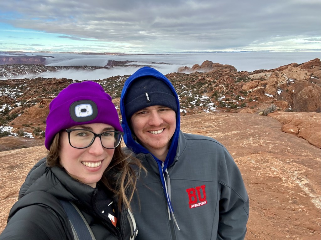
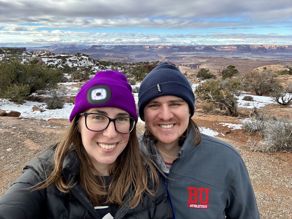
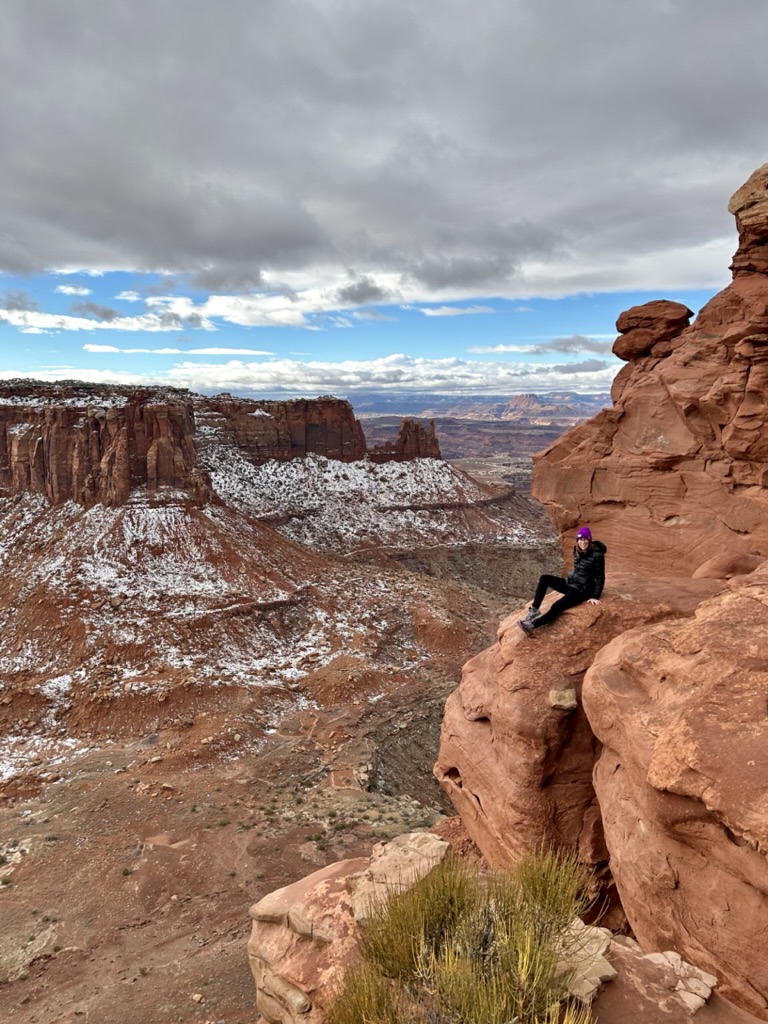
I was debating between the White Rim Viewpoint Trail and the Grand Viewpoint Trail. They’re both relatively flat, similar distances, and very close together. Ultimately I decided on Grand Viewpoint just because it was on the Southern tip of the Island in the Sky and you could see both rivers on either side of you.
I think we made the right call.
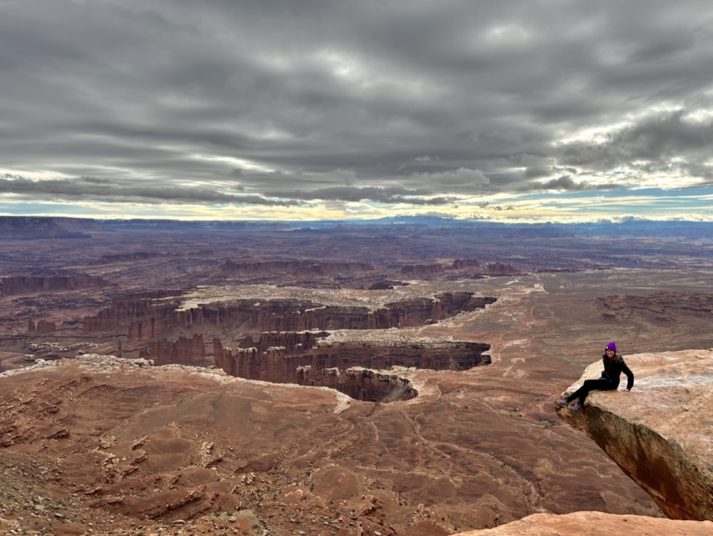
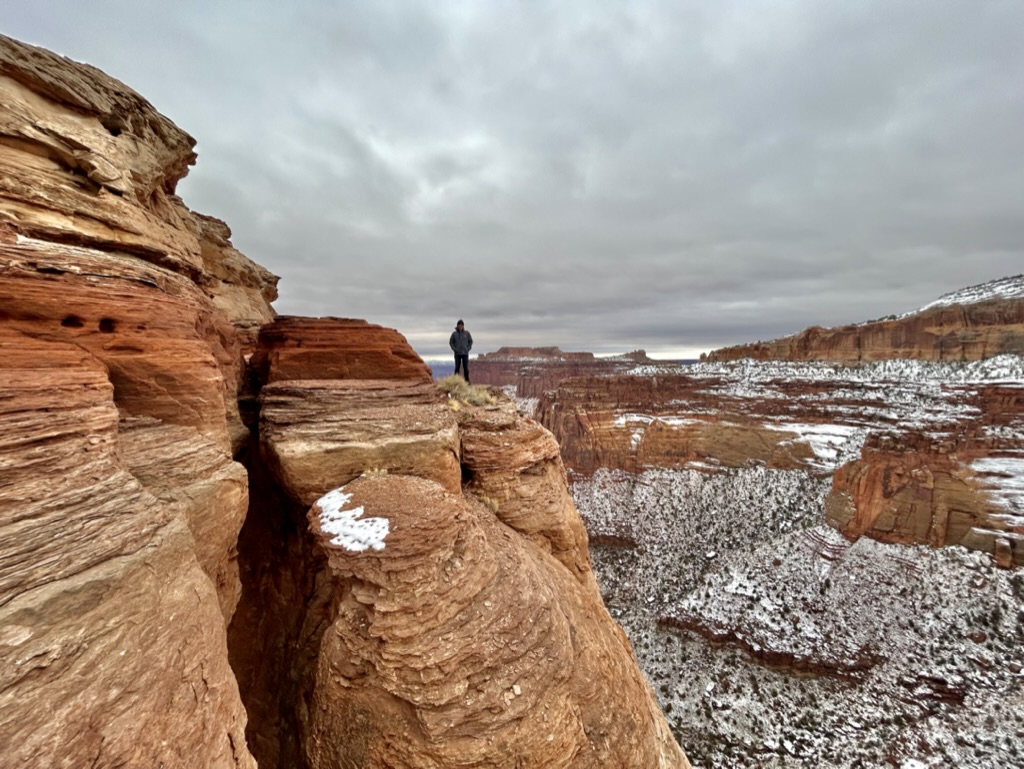
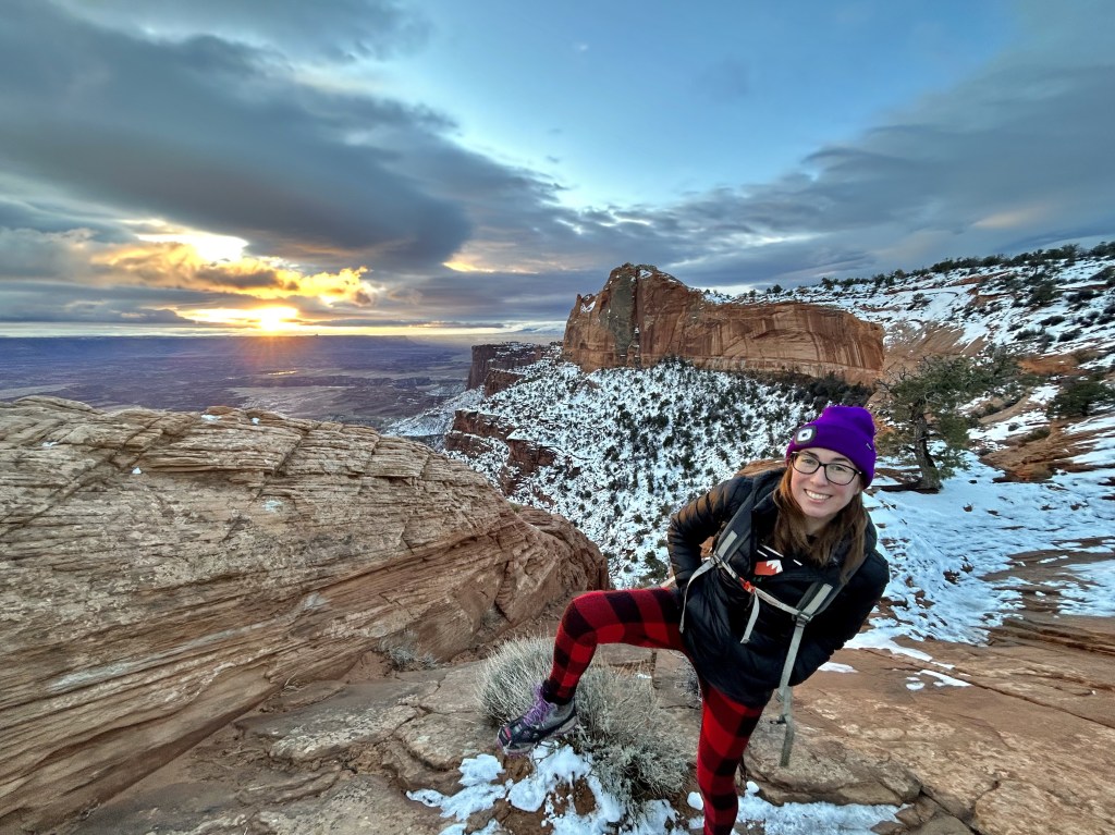
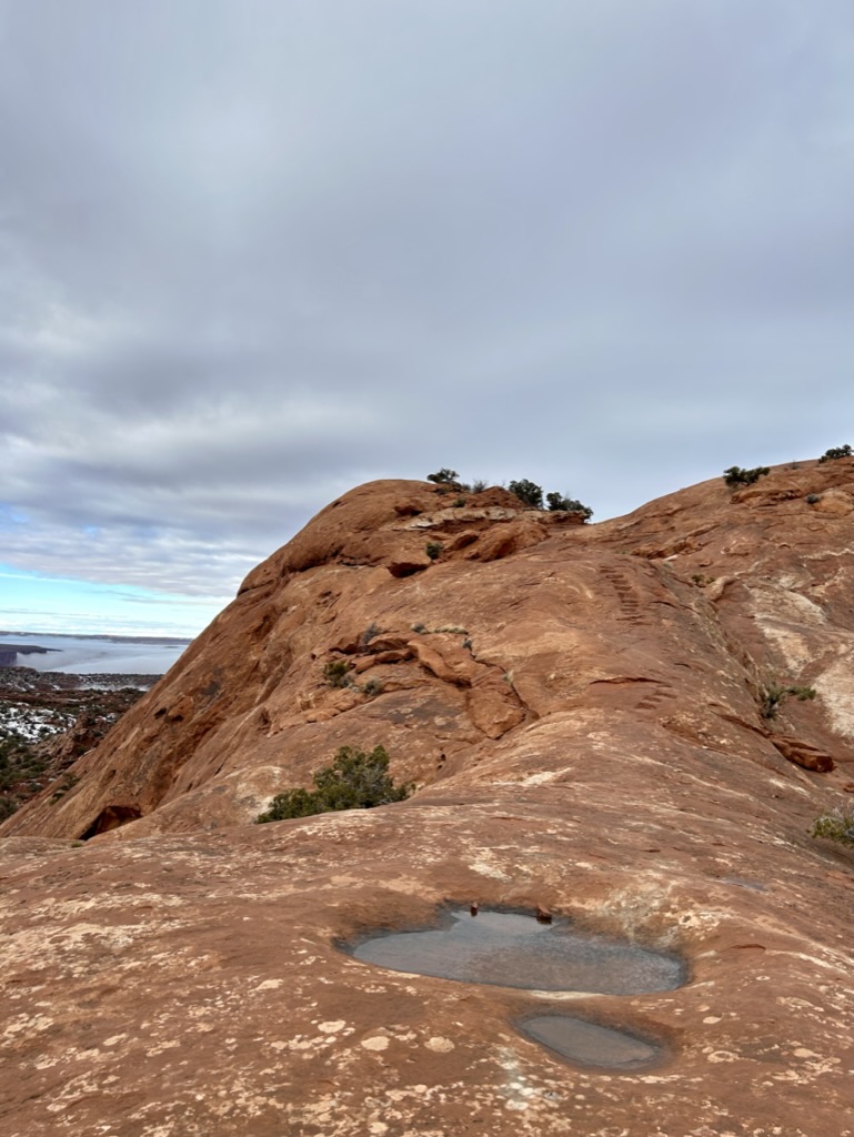
The above picture is looking East toward the Colorado River. Remember, the Rim immediately beneath me is 1,200 feet down and the canyon down to the river is another 1,000 feet. It was just impossible to register how high up we were. (Also, I was a big dummy and while trying to pick the best place to sit for this picture, I sat directly on that sheet of ice you see behind me. Not my best move. I was obviously didn’t slip and slide off the rock, but I did have a wet butt for the rest of the hike.) The Rim below me is also where that backcountry road is. It’s hard to imagine people just driving around and camping down there, the road just looks so tiny and fake.
The trail got icier and slushier the further we got and it took some hopping around from rock to rock, but it was well worth the views at the end.
Behind that butte (the rock formation…and James hehe) is where the Green River and Colorado meet, but you can only see the confluence from down on the rim or a viewpoint all the way over in the Needles section of the park, a two and a half hour drive away. I really liked the end of this hike, and not just because I got to climb on a lot of rocks and make James take scary-seeming pictures of me.
There were beautiful panoramic views of the entire area and we only saw a handful of other people the entire time we were there. Canyonlands is truly a hidden gem that isn’t really that hidden. It is so worth the half hour drive from Arches! Just be prepared. Fill up on water at the visitor center during their open hours. Know what the road conditions are on the main roadways before you get there. And plan far ahead and make sure you have an appropriate vehicle if you want to make the trip down to the White Rim for some backcountry exploring. I’m sure it’s worth it!
So we said our goodbyes to this underrated beauty and began our journey over to our third Utah national park: Capitol Reef. Which took us on a new section of interstate (always exciting for me!), and the drive from the interstate down to Capitol Reef was absolutely stunning. None of my pictures did it justice and honestly you just need to do it for yourself. What I DID get a picture of was this AMAZING milkshake at Stan’s Burger Shack in Hanksville on the way.
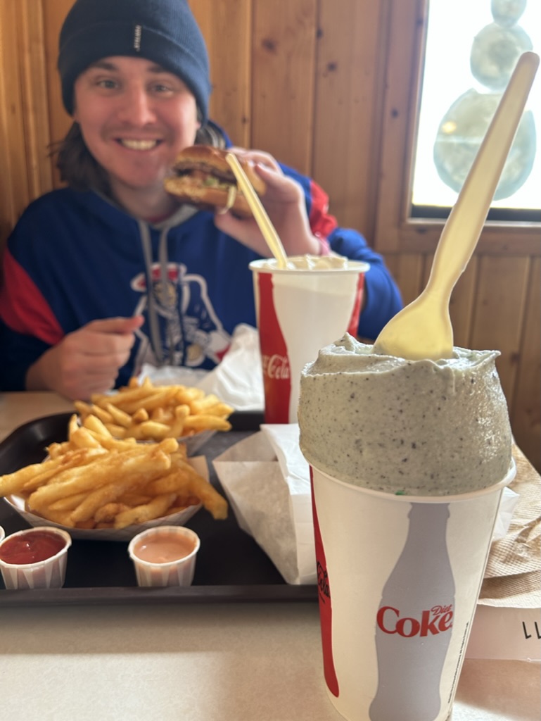
This meal gave us LIFE and was everything we needed to power on to our next adventure. Until next time!
