We made it, folks! The Utah Mighty Five! I have been dreaming about this road trip since I first found out that National Parks were even a thing. When we got a taste of the beautiful Utah desert back in 2018, my excitement only grew. I have been waiting ever since for BU Hockey to go back to Arizona so we could have an excuse to make this trip a reality, and it finally happened! And the timing worked out perfectly for us to have two full weeks in the Southwest. It was meant to be.
We began our trip hanging in New Mexico with some friends and checking out White Sands National Park, but then it was finally time for us to head off to the Mighty Five.
Quick(ish) anecdote about our rental car experience: when I rented our car at the Phoenix airport the guy asked me where we were headed. I kept it vague because I know they just look for ways to try to upsell you. Which he immediately did. I had obviously chosen the cheapest option (which also tends to be the most MPG-friendly option) and he really tried to convince me that this little rear wheel drive economy car would not cut it in the snow where we were going. In not so many words, I informed him I grew up in Northern New York and I currently live in New England and have driven my tiny little Honda Fit through approximately 5,000 blizzards, so worry not!
He then tried to lie to me about the weather in Albuquerque without realizing that he was talking to an actual crazy person who had the weather forecast for every single place we were going in the next two weeks memorized. Eventually he realized I was not who he had sized me up to be and, after one last pleading look to James (to, I don’t know, talk some sense into his woman?) he gave up. But not before making sure to personally walk us to our car. (We had been in line for about half an hour at this point and not a single other customer had been walked to their car.) I have to assume it’s because he thought once we got there and I saw the car I would immediately break down crying, fall to my knees, and beg him to take all my money and get me the biggest SUV on the lot. Spoiler alert: I did not.
And I am convinced to this day that he intentionally got us the tiniest, most piece of shit vehicle they had just to spite me. This thing was a 2021 Chevy the size of my bathtub with manual locks, roll down windows, manual rearview mirror adjustments, and no cruise control. But jokes on him because I would put up with SOOO much more discomfort to save WAYYY less money.
So we finagled all our luggage (and we had a lot!) into the back and headed on our way.
I bring this all up now because it wasn’t an issue getting to Albuquerque at all. And our friends were nice enough to drive us around in their cars while we were there. But I learned something about New Mexico that last day as we began our drive through Northern New Mexico to Arches National Park. They DO NOT know how to treat their roads for snow.
Now. As someone who follows her favorite college hockey team around New England and the Midwest in her car every winter, I could give you a full report card for just about every state on their ability to handle snow storms. I didn’t think it could get much worse than Indiana, but it turns out it can. Because these states both have this fun thing in common where they don’t salt their roads, they just put beet juice on it. You may think to yourself, ‘that’s absolutely crazy, there’s no way that works!’ And you would be correct.
It didn’t even snow the morning we left! It had snowed THE NIGHT BEFORE and they did not salt nor plow their roads AT ALL. These were state highways that were borderline unpassable at like 10am. I just don’t understand. New Mexico DOT, be better! You never want me comparing you to Indiana, trust me.
And then as soon as we crossed into Colorado, the roads were magically clear. Go figure. But it was fine, we made it. And please DO NOT tell the Hertz Rental Car worker that I complained about driving through the snow. I’m begging you.
Okay, that was a longer rant than I expected. I promise to reward you with pretty pictures now.
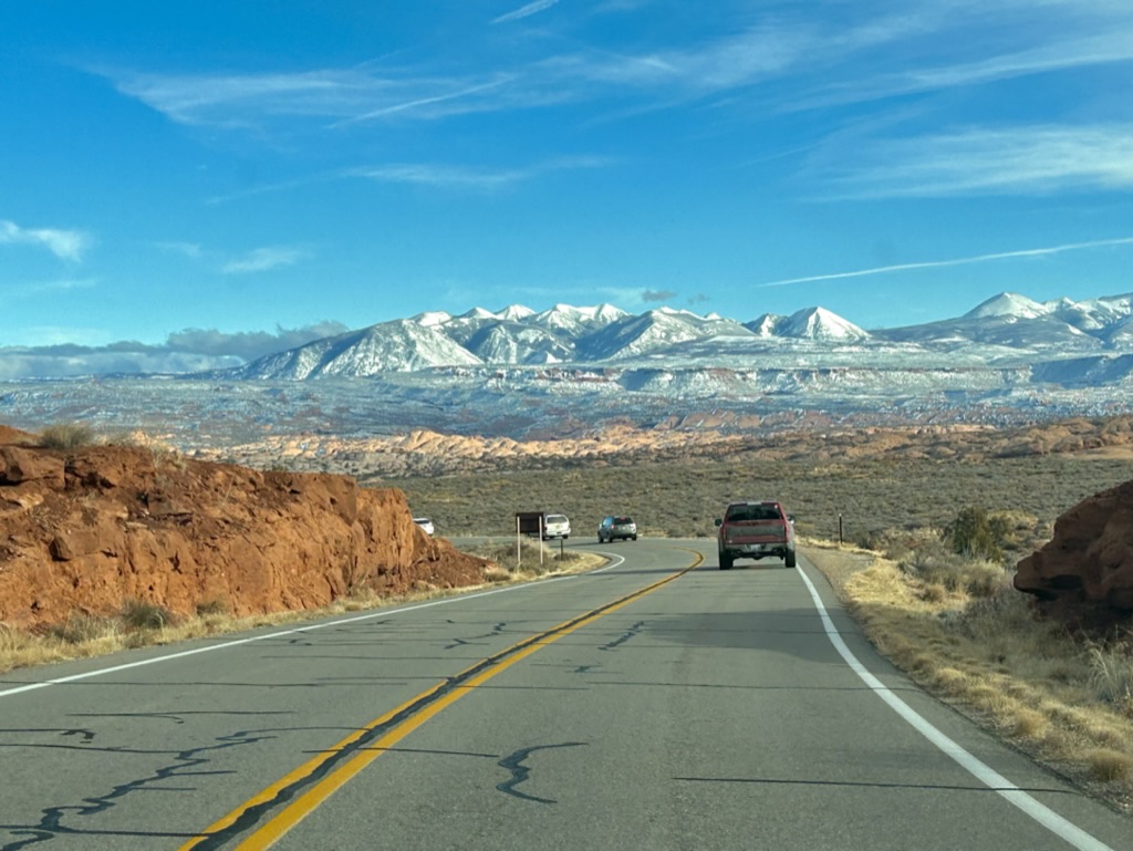
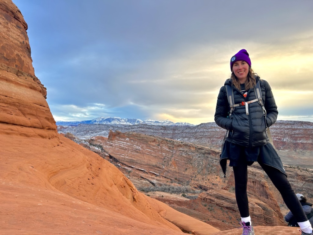
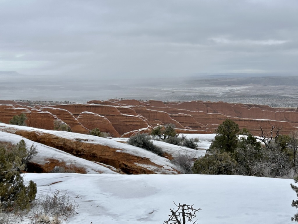
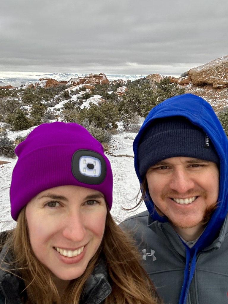
So finally, we made our way through beautiful Colorado and over into Utah. The drive down into Moab was absolutely stunning. The snow capped La Sal Mountains welcomed us to this beautiful region of the United States.
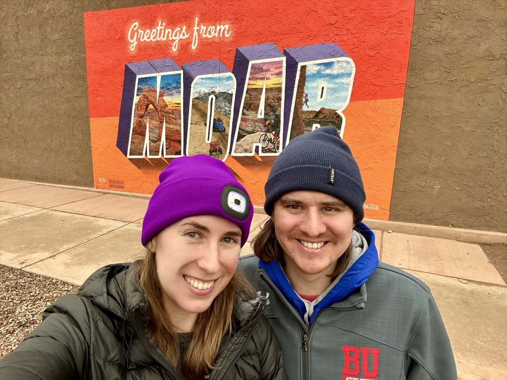
For the record, it is pronounced Mow-Ab, two syllables. And it is the quintessential National Park town, like Gatlinburg or Jackson Hole. And it holds not one, but TWO national parks within its borders.
First up: Arches.
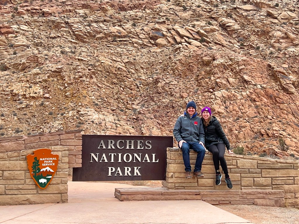
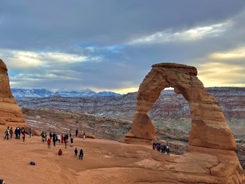
I knew very little about Arches National Park when I first started planning this trip, except for–well–the arches. Delicate Arch to be specific. The one on the license plate! Just Google it, I’m sure you’ve seen it. But this park is so much more than just that one arch. In fact, Arches is home to over 2,000 arch formations within its borders. You can really only begin to scratch the surface in a single weekend.
I would’ve obviously loved more time at all of these national parks, and as soon as we got back I was already planning a return trip (mostly for the things we had to miss due to the snowstorm later in the wek). But I’m getting ahead of myself.
I tried really hard to not overplan the beginning of this trip (which is a very difficult for me). I wanted us to have some flexibility in case anything went wrong or the weather wasn’t cooperating, etc, etc. So I didn’t book any campsites for the first few nights and was hoping to stay in the first-come, first-served sites in the national parks. (Most National Parks are first-come, first-served in the winter months except the big ones like Zion and Big Bend, etc.)
And speaking of Big Bend! That trip made me nervous about the crowds we would see in Arches and whether or not we’d even get a campsite (don’t worry, I had plenty of backups ready to go). Because when we stayed in Big Bend, three years TO THE DAY before we arrived in Arches, the campgrounds were all completely booked up for the week between Christmas and New Years. And several people told us on that trip that there wasn’t any vacancy anywhere in the surrounding towns either. So I was really nervous going into this that the same must be true for Arches and Moab. Arches is surely more popular than Big Bend, it’s on their license plate for crying out loud!
So when we pulled up to the Entry Point about two hours later than planned because of stupid New Mexico and their stupid roads, I asked the park ranger if she thought there was any chance in hell that there would still be an open campsite this late in the day. And folks…she laughed in my face. And very sarcastically said, “yeah…I think you’ll be alright.” I was honestly pretty stunned. So I just grabbed the map from her and drove along. And then James and I remembered that we saw a lot of places in Moab that were advertising low nightly rates and plenty of vacancy. Had I misjudged all of this? Why are people going to Nowhere, West Texas in DROVES during Christmas break, but not the most popular cluster of national parks in the entire National Park System? And hadn’t visitors drastically increased in general since the pandemic? I still don’t have an answer for you.
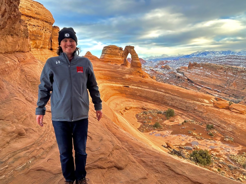
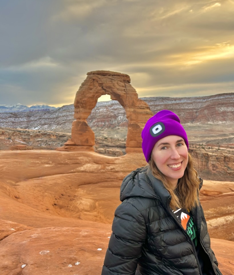
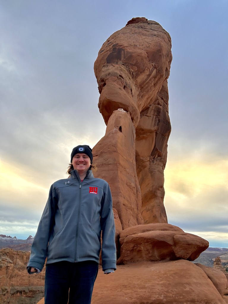
So I decided to trust my girl and we went straight to Delicate Arch instead of snagging a campsite first. It was slightly out of the way and would have cut into our chances of seeing the arch at sunset. I told James I could live with myself if we had to stay somewhere else in Moab tonight, but I could not live with myself if I missed an opportunity to see Delicate Arch in the setting sun.
It was the right call.

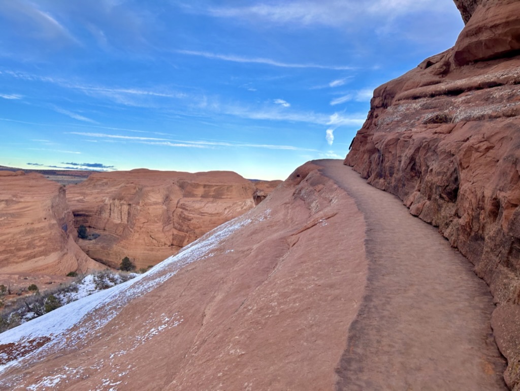
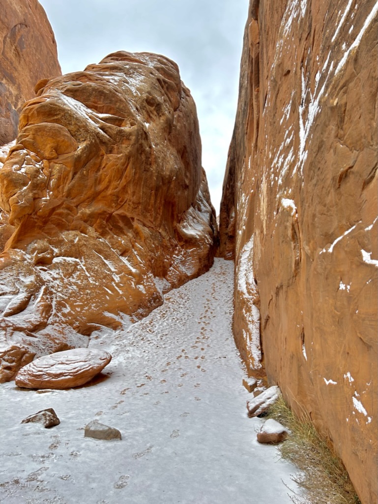
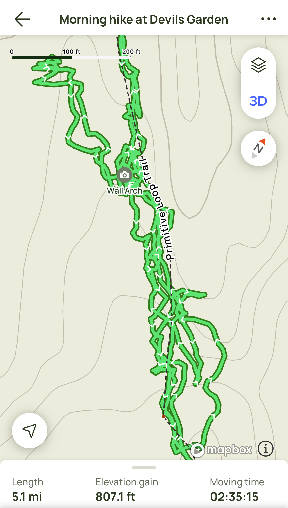
The hike to Delicate Arch is a moderately easy 3.2 mile out and back trail that gains about 650 feet in elevation. It begins with that quasi-boardwalk seen above, before going through some switchbacks, and then ultimately up the side of that very large, flat rock. Most skill levels can do it.
And that meant it was CROWDED! Now, I’m never one to complain about lots of people in national parks. (You aren’t stuck in traffic, you ARE traffic.) This is why we intentionally travel to these beautiful places during the off-seasons. Arches institutes timed entries from spring-fall because of overcrowding, so winter is truly the best time to go! All this to say, it was still a lot of people. I turned to James at one point and asked him if he remembers ever being on a more crowded hike. We couldn’t. But it certainly didn’t take away from it! You just have to be patient and hike your own hike.
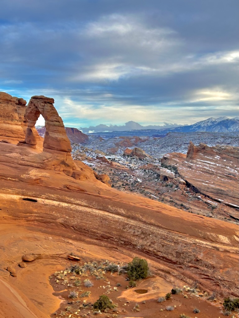
And you forget all about anyone else once you see that view!
This is the first viewpoint you come to. It’s pretty easy to miss if there aren’t already people there looking, so just keep an eye out for a giant window in the rock to your right just before you reach the end of the trail. It involves a little bit of rock scrambling to get to this point, but it’s well worth it in my opinion.
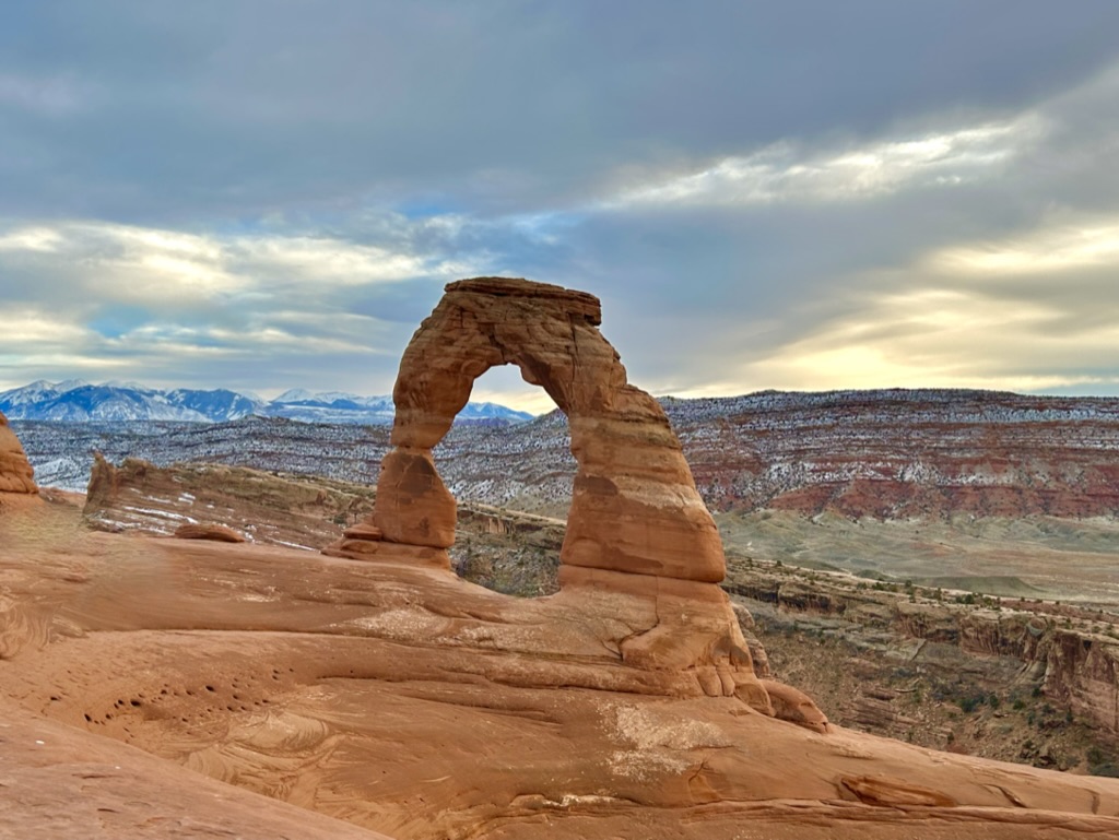
And from there you just go around two more corners and ta-da! You’ve made it.
Full disclosure: I did a decent amount of editing for some of these pictures. Here’s what it actually looked like up there:
Again, could’ve been worse. It’s also pretty easy to time it so that people aren’t directly underneath the arch and use the surrounding rocks to frame your photos and crop the people out. Yes, it’s crowded, but everyone deserves to see these beautiful landmarks as much as you do. You can find your own little spot and make the best of it.
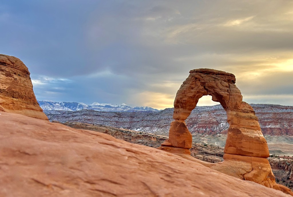
I’m not going to lie, I was pretty bummed that the sun couldn’t peek out just a little bit (after being out all damn day) to give us that iconic sunset shot of the arch with the golden sun lighting it up, but that’s just how it goes sometimes. These stupid national parks always giving me a reason to go back someday.
But the entire experience was still obviously incredibly beautiful.
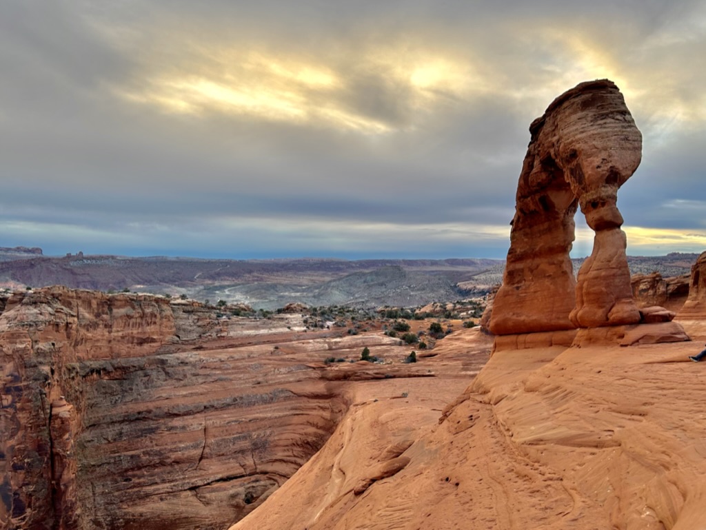
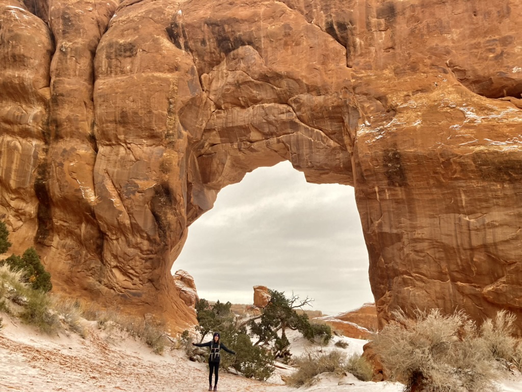
You can really see just how delicate the arch is from this angle. She stands nearly 52 feet high and has been around for thousands of years. I’ll discuss more about her likelihood of collapsing (and other historical collapses in the park) when we get to Devil’s Garden, but it’s fairly unlikely she’ll collapse in our lifetime, as long as humans don’t interfere. From this angle it looks like it’s more likely to fall off the edge of the cliff than collapse. Which hey…you never know.
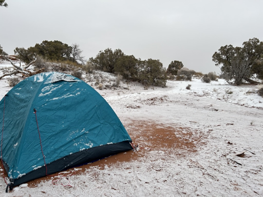
After over an hour of staring at this miraculous formation and exploring it from all angles, it was finally time to head back down to the car and go to the campground. To find out if our park ranger had led us astray and ruined our plans for the night. But luckily, she was right! And as we got there at twilight, there were still plenty of open campsites for us to choose from. We quickly set up our tent in the cold, fired up the JetBoil to cook a dehydrated dinner, and got ready for bed. (It is honestly cruel to make the bathrooms heated at a campground. I never wanted to leave.)
It wasn’t nearly as cold as when we camped in Big Bend, and I was quite comfortable all night. Well, temperature comfortable. You never quite get used to sleeping on the ground, even when you do it for two and a half weeks straight.
And then we woke up the next morning to a fun little surprise!
Another spoiler alert: the fact that it snowed on our tent is about to become very relevant for an absurd story at our next national park. Stay tuned!
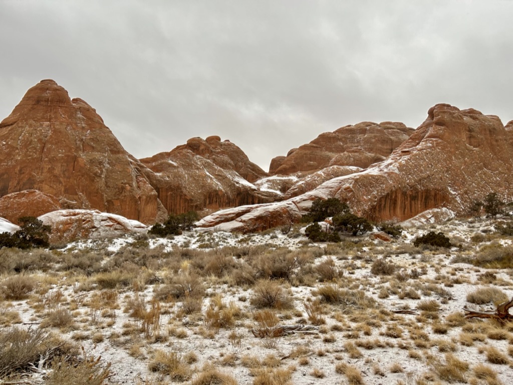
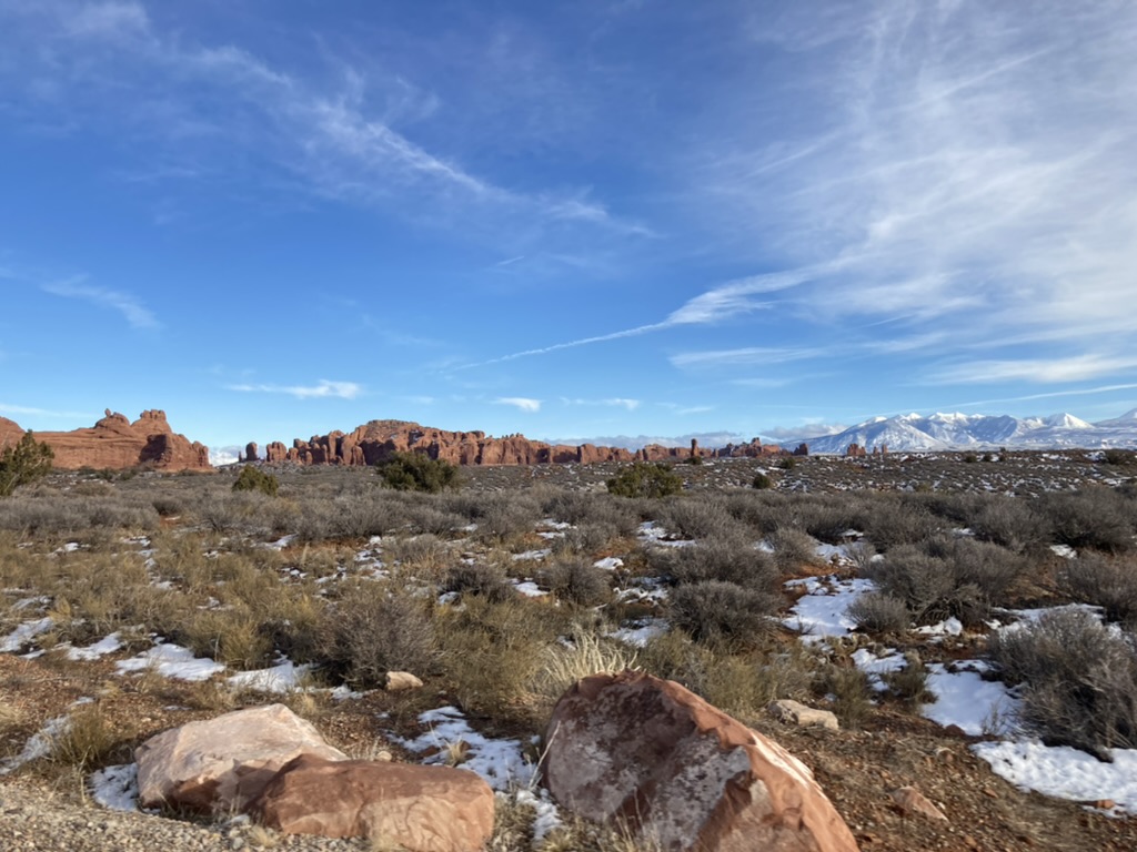
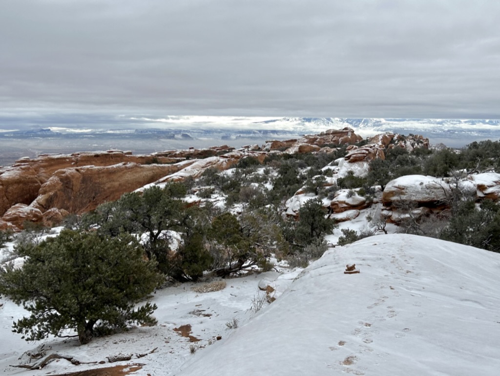
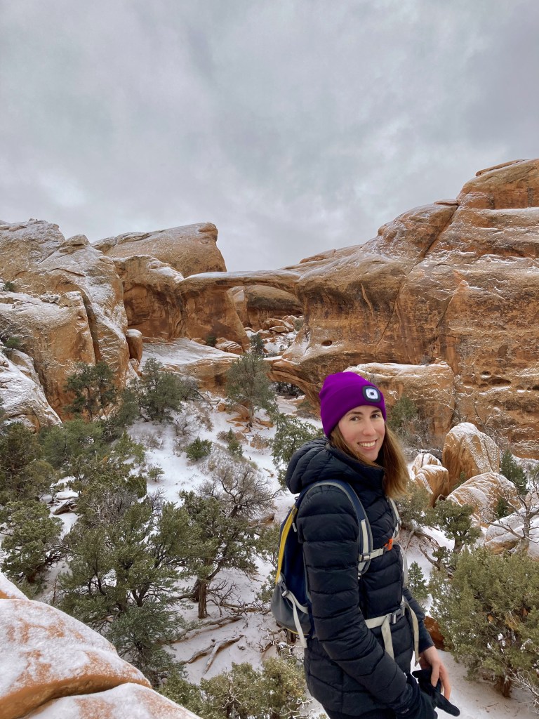
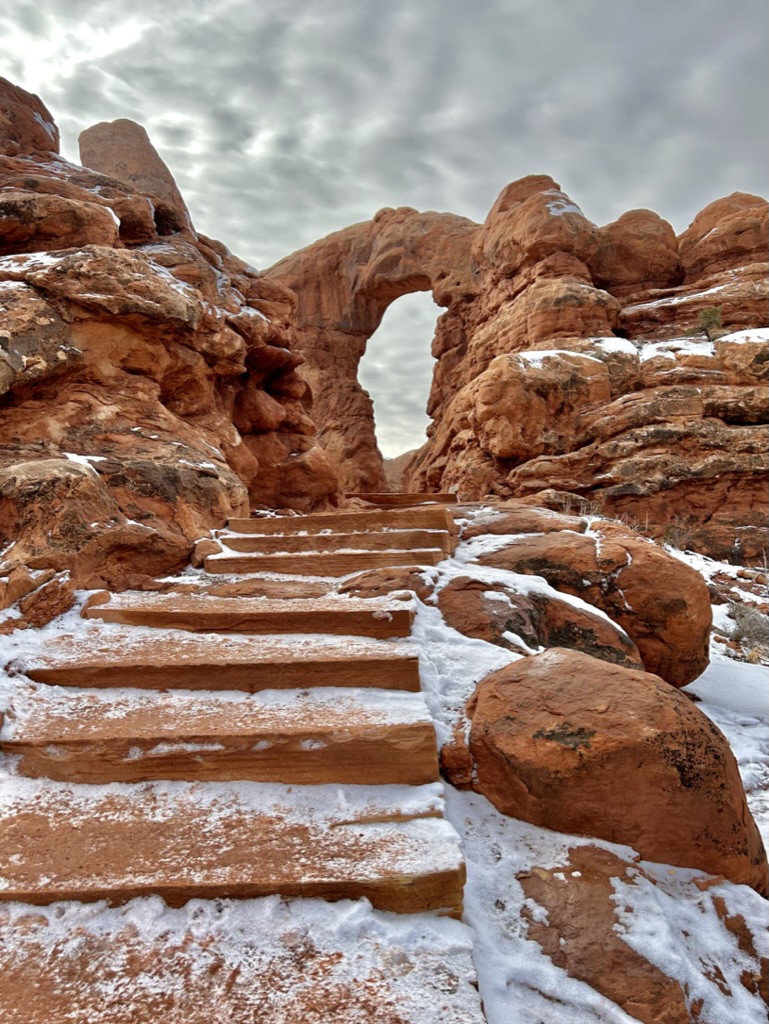
But for now, the fresh coating of snow made everything even more beautiful as we made our way across the street to Devil’s Garden, an area with a very high concentration of easily accessible arches. We were some of the first people in the parking lot (benefits of actually camping inside the parks!)
Now, here’s where Nicole and James made the first (of admittedly several) bad decisions. After stepping onto the trail, I realized it would probably be a good idea for us to bring our spikes for our hiking boots since it was fairly snowy and moderately icy. But, you see, we had already walked for like two minutes by the time I remembered and I reallyyyy didn’t want to have to go allll the way back to the car. So we decided to just plow on ahead for this hike and throw them in our pack going forward.
Do as I say, not as I do. ALWAYS BRING YOUR SPIKES OR CRAMPONS IN SNOWY AND ICY CONDITIONS. ALWAYS.

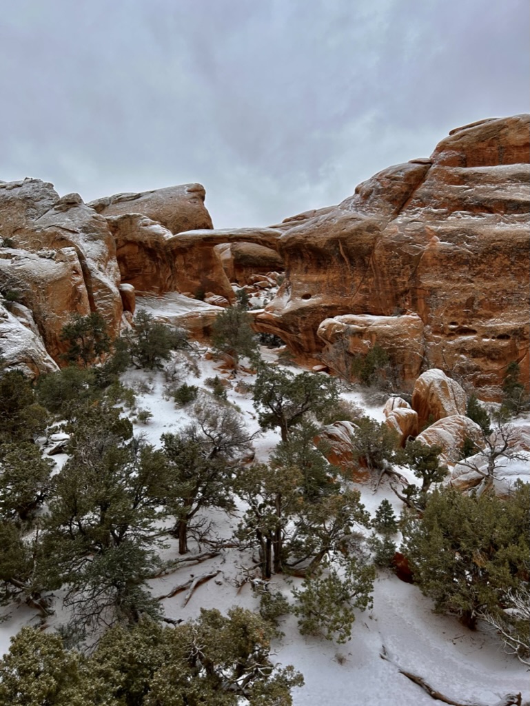
Devil’s Garden is an 8 mile loop if you do the entire thing and stop at all the arches on spur trails throughout, but we set out to go to Double O Arch and turn back, assuming the less popular back half of the trail would be difficult to pass in the snow this early in the morning.
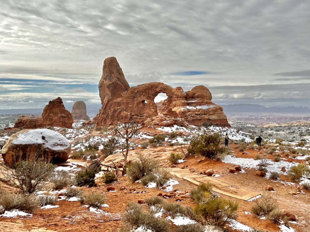
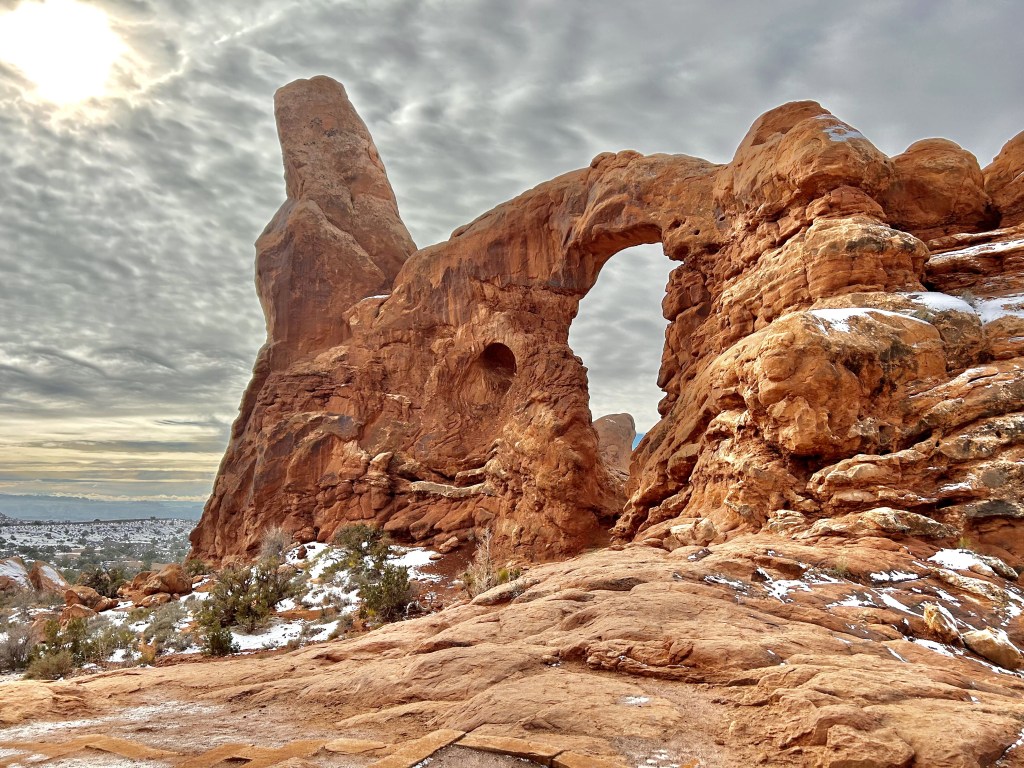
So we started here at Tunnel Arch, a quick side trail that was a little icy and sketchy going down, but nothing we couldn’t handle.
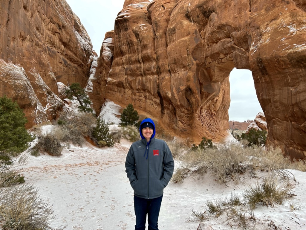
The next spur trail brought us to Pine Tree Arch…because there was a pine tree in the middle of it. They definitely didn’t overthink these names.
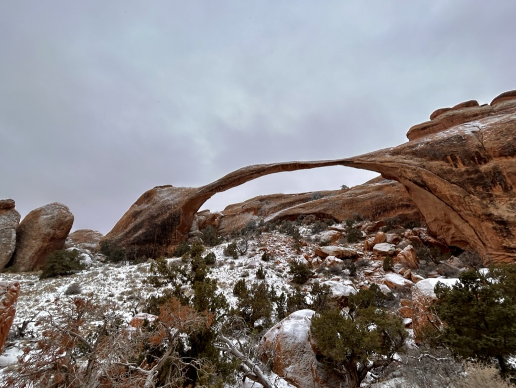
From there we continued on to Landscape Arch, the longest natural arch in the entire world at 306 feet long.
Pretty cool! The trail used to bring you right up under the arch, but a large chuck of it fell in 1991, which this very lucky hiker caught on camera (and luckily didn’t get caught underneath!):
https://www.nps.gov/media/video/view.htm?id=12AA9277-D6E4-D97E-DAF1BEC7A384653F
The piece that fell off was 60 feet x 11 feet x 4 feet! That’s crazy. A few more chunks fell off in 1995 and they permanently rerouted the trail to stay far enough back. This is as close as you can get now. And while it looks paper thin, the rock is still 6 feet wide at its skinniest, but it really doesn’t look like it will hold on much longer…though it’s been that way for almost 20 years now, so who knows?
The Landscape Arch partial collapse isn’t the park’s most significant collapse in recent years. Wall Arch, which would’ve been the next arch we came to on this hike, completely collapsed on August 4, 2008 in the middle of the night. It was so loud that people over a mile and a half away in the campground we stayed in were awoken by it in the middle of the night. It’s so crazy to think that something that has been there for thousands and thousands of years finally collapsed in our lifetime. Thankfully it happened in the middle of the night and nobody was injured.
So even though we walked right by it on our way to Double O Arch, James and I didn’t even notice the wreckage of this fallen arch because we were too distracted trying to find where the heck the trail went. As evidenced by this very funny screenshot from the AllTrails app:
We literally hiked over a mile back and forth in this one tiny section, unknowingly going up and over the fallen arch a bunch of times, trying to find the trail we were supposed to follow.
And we were not alone! At least six other hikers caught up to us at this point and we were all wandering around like chickens with our heads cut off trying to find the correct trail. I think it’s probably clearer when it isn’t blanketed in snow because by the time we came back down, people were finding the trail no problem.
I honestly didn’t even realize that we were literally on top of a fallen arch until just now as I was doing research for this post. Kind of crazy. And in retrospect, it was this collapsed arch (along with the snow coverage) that led to our confusion. Where the arch would’ve once created a pretty clear path up the trail, it was nothing but chunks of rock and smooth cliff faces.
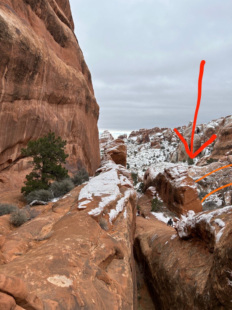
The red arrow in the photo above is where one side of Wall Arch used to start. And the orange arcs are my attempt to draw what the arch once looked like. That makes sense, right? …right? I’m just glad I caught it on camera without even knowing!
Eventually we did find the trail, which was where we originally thought it was, it was just very sketchy in the snow and ice. The other group also found the trail up ahead by plowing through some other rocks that just happened to link back up to it. At the end of it all, there were about 8 of us who made it up and out of the “valley.” And only two of us would go on to make it to the end! **cue dramatic music**

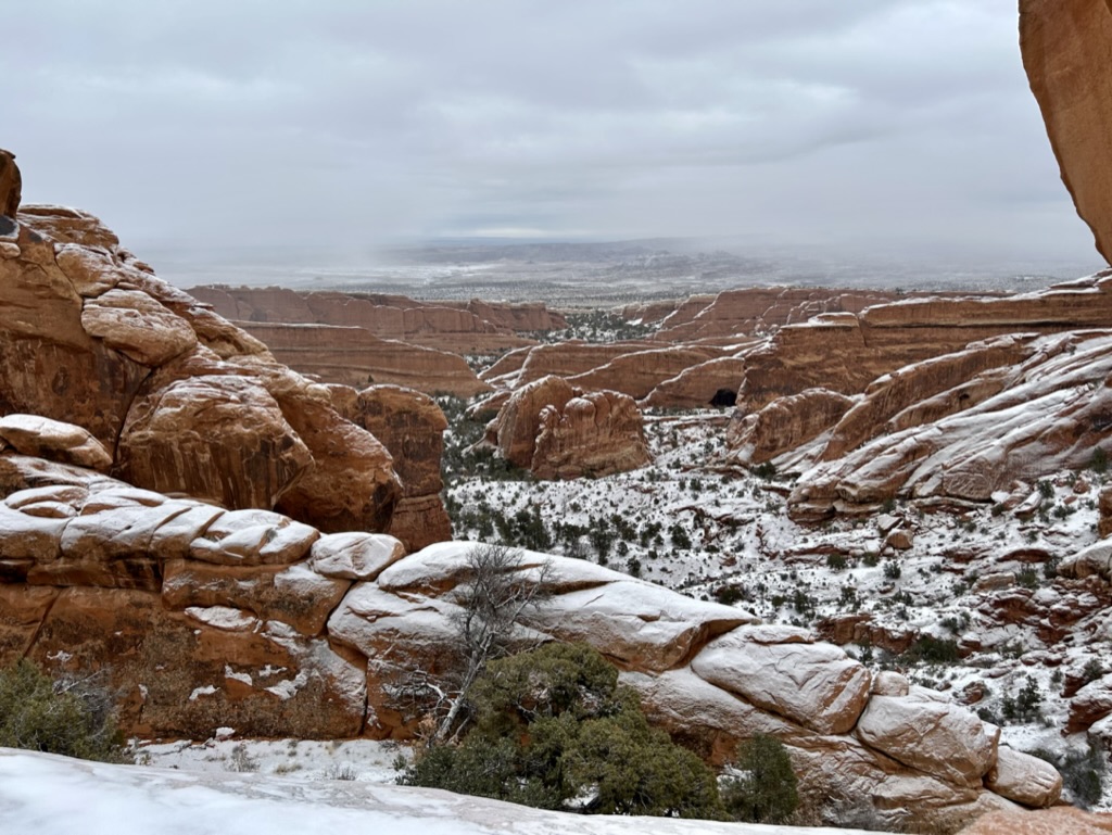
As we continued on, up and out of the valley, you could really start to see exactly how the arches formed. These structures in front of us are called fins and are caused by centuries of water, ice and wind erosion through the sandstone, separating it into these skinny strips or “fins”. Erosion then continues through the middle of these fins until they are hollowed out and become the arches we know and love. Science!
Around this lookout, we officially caught up with the other hikers who had managed to find the trail. We had arrived at another impasse. There was a sheer, icy twelve-ish foot tall rock that it appeared we had to scramble up to continue on. One climber had made his way up and was doing reconnaissance to make sure the trail actually did continue that way. I really wish I had taken more pictures at this point to show what it was like, but alas, we had bigger things on our minds. I, being the person I am, wasn’t going to just let some man do the hard part and tell everyone else what to do. So I mapped out the best route and followed him up the sheer rock face, with James right on my tail. I’m making it sound more dangerous than it was. Even if we slipped, it would’ve only been a couple feet of sliding down the rock to land below. As long as we stayed low and watched our footing, we were fine.
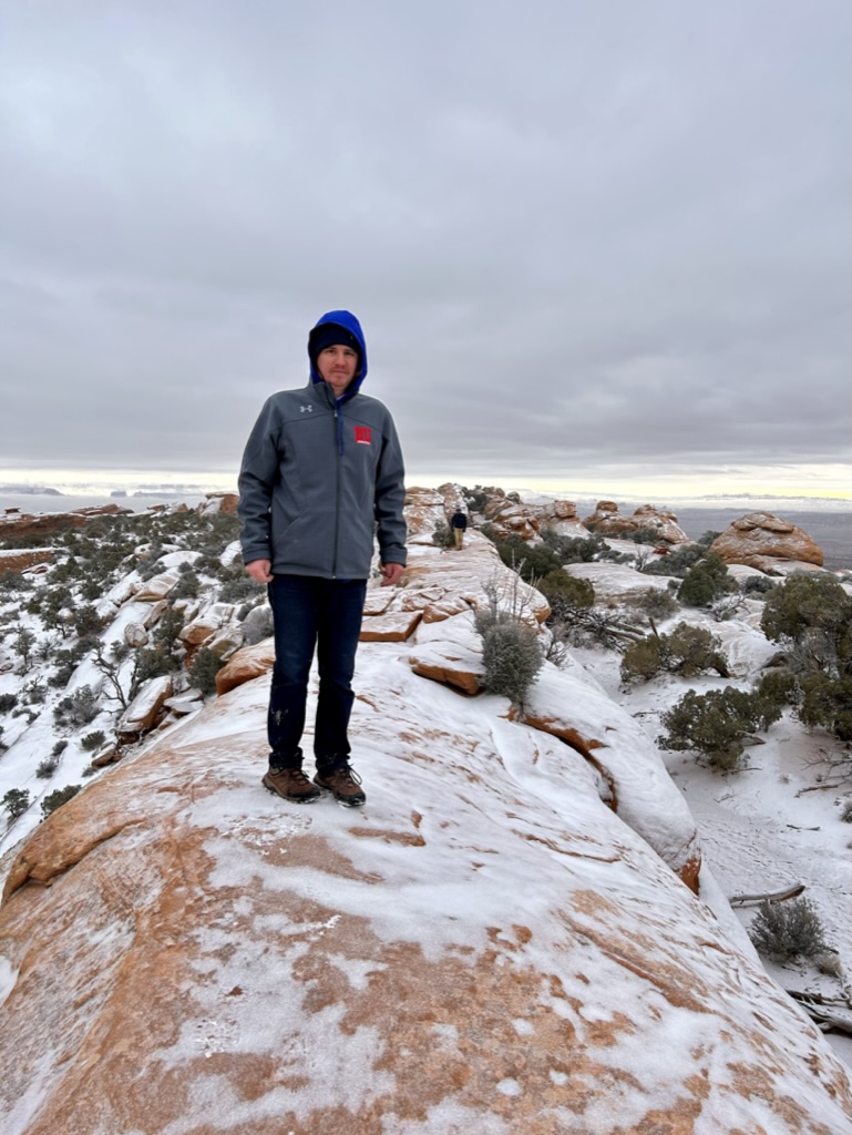
We made it up no problem! James looks so thrilled. You can kind of see in the above picture the drop off on either side of this thin strip of trail and our footprints down to the right. That’s what we had to scramble up. Again, it looks worse than it was. So we followed our buddy further down the trail, watching our footing on this very icy strip of rock, including some sections where we had to jump over small gaps. It became clear that this was the correct trail so our guy decided to go back to his friends.
So then there were two.
You could see even cooler fins from up there. Look at all those future arches!
At this point, it was just us and a single set of footprints ahead of us. I have no idea who this brave soul was who had clearly done this hike by themselves, very early in the morning. But I am so incredibly grateful to them. Having footsteps to follow made it so much easier! Less time staring at our map and trying to figure out where to go.
But then at one point, the footsteps just stopped. It wasn’t near a ledge, it wasn’t near the end. I never saw them going back the other direction. There was no sign of a fall. I honestly have no idea what happened to this person. No one ever went missing (yes, I checked for weeks after we got back). They must have found a different route back down and around, but I will be forever baffled by this mysterious, unknown guide.
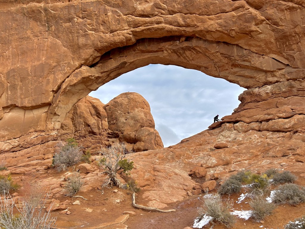
So now we were REALLY on our own with AllTrails telling me that we were OH SO CLOSE to the Double O Arch, but things were getting more and more precarious. I deduced that the arch must be just on the other side of this–you guessed it–steep, flat, icy rock cliff. But this was different. It was only about an eight foot climb, but if you slipped here, you would keep going a lot further down into the valley. There wasn’t a wide landing place below to stop your slide.
Now, at no point was I worried that we could die or seriously injure ourselves. I’d like to think that even I wouldn’t have done this if that were the case. I deduced that the worst case scenario was we’d lose our footing or grip and slip down dozens of feet of rock. It wasn’t like a perpendicular drop off, it was more like a fun slide. The challenge then would just be finding a way to get back up to the trail. We could do that! So on I went. With James far behind me so that if I did fall, I wouldn’t take him with me. And using every ounce of grip my fingers, the packed snow, and my hiking boots could give me, pulled myself up over the cliff and found a flat landing place at the top. And more importantly…DOUBLE O ARCH!
Now, this was certainly not the most impressive arch we saw, but I think it will always be my favorite because of the sheer amount of skill and willpower it took to get there. And the fact that I’m pretty sure I was the only person to get this picture at least until later in the afternoon once the sun came out and melted some of the ice. In climbing up the rock, I had displaced a lot of snow that was the only grip I had, making it very difficult for anyone to follow me. Including James. Luckily I could see a better route for him to get at least to a place where he could see the arch. And more importantly…snap this picture of me. Just kidding.
From there I could see where the trail was supposed to go if you wanted to continue the 8 mile loop around, but there was no way in hell we could safely get there in these conditions. Plus, we’d seen Double O, I was ready to head back. So I got down on my butt and road the forbidden slide down, making sure to grab onto a tree at the trail to stop myself from sliding all the way back down into the valley. Easy peasy!
On the slow, meticulous hike back down we started passing our buddies one by one. Everyone thanked us for giving them footsteps to follow and asked us how the conditions were ahead. I tried to be as honest as possible and let them know that it would be very difficult to get to see the arch. But I also know myself and if anyone had told me that, I certainly would have kept going to prove them wrong. Which they all did. And I hope they all made it!
Funnily enough, on the way back down, as we noticed how much clearer the trail was to follow with less snow, we also noticed a sign telling you to absolutely not go any further than Landscape Arch in snowy and icy conditions. Oops. You live and you learn. And now I can pass this knowledge on to you: always ALWAYS pack your spikes in wintry conditions and always read the warning signs (even if you know you’re going to ignore them and keep going anyway).
From there, we bid adieu to Devil’s Garden and decided to make our way slowly out of the park, stopping at all the points of interest we wanted to check out on the way.
First up: Balanced Rock.
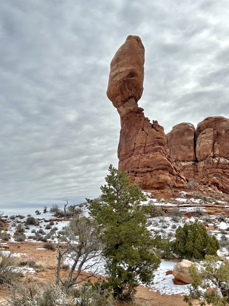
Again with the well-thought out names.
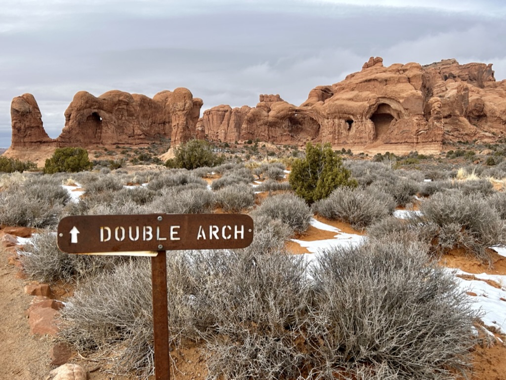
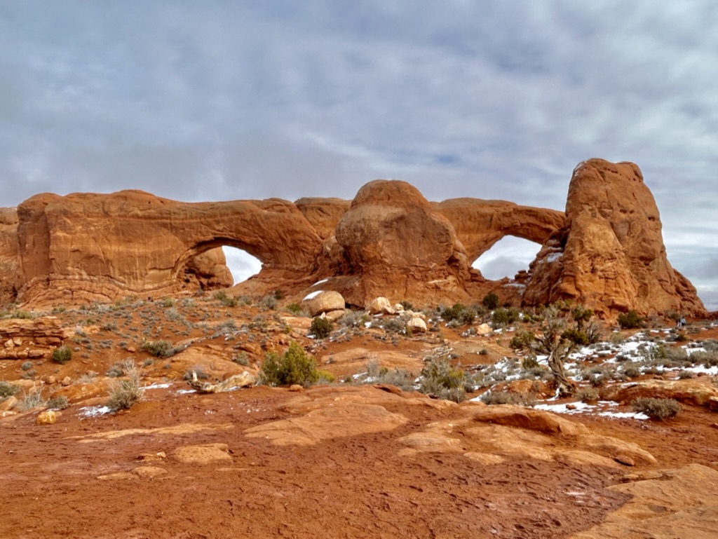
Then onto the Double Arch/Windows Arch area of the park, a quick offshoot from the main road that is DEFINITELY worth checking out.
This entire area looked like another planet.
Like…what even?
I’ll try keep the rest of this post brief because, oh baby, did I drone on and on in this one. But this whole area could be explored in less than an hour depending on how much you want to actually climb up into the arches. We just wandered from one area to the other and looped around and had a blast.
Don’t tell Double O Arch, but I think Double Arch (I know, confusing) actually ended up being the coolest arch we saw.

It was just SO big! Look at how tiny all those people look climbing up into it. Insanely cool.
And the real reason it was probably my favorite area: I got to climb on lots of rocks (non-icy, not scary rocks!)
As I said, there was plenty more to the park that I would have loved to explore if we had more time, namely the Park Avenue hike, but I still left feeling like we had seen everything I absolutely needed to see. Arches was the perfect way to kick off our trip to the Utah Mighty Five and I’m so grateful that we didn’t experience crazy overcrowding (or sweltering summer temperatures).
This park should absolutely be on your bucket list. All the hikes were relatively easy (in better weather conditions). Moab is amazing. And there’s so much you can see without ever leaving your car. It truly never gets old seeing a different natural arch every which way you turn. Plus…Canyonlands, another park in the Mighty Five, is RIGHT UP THE STREET!
So after a stop in town to stock up on groceries and firewood, top off the gas tank, and scarf down HUGE burritos at a local Mexican place, we were on our way toward Utah park number 2 of 5: Canyonlands National Park!
Truly thank you thank you thank you if you actually made it this far. This was a wordy one. I highly doubt I’ll have this much to say about any of the other Utah parks, but NO PROMISES! Much love.

One thought on “Arches National Park”